Photo corners
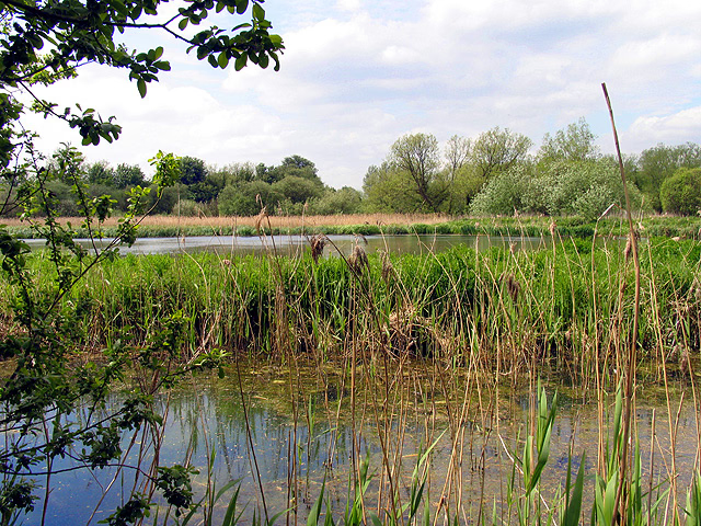
Thatcham Reed Beds
Oxford, United Kingdom
Thatcham Reed Beds is a 67.4-hectare (167-acre) biological Site of Special Scientific Interest east of Newbury in Berkshire. It is part of the Kennet & Lambourn Floodplain Special Area of Conservation and an area of 14 hectares (35 acres) is a Local Nature Reserve. An area of 35 hectares (86 acres) is managed by the Berkshire, Buckinghamshire and Oxfordshire Wildlife Trust. Thatcham Reed Beds is important nationally for its extensive reed bed, species-rich alder woodland and fen habitats. The latter supports Desmoulin's whorl snail (Vertigo moulinsiana), which is of national and European importance. A large assemblage of breeding birds including nationally rare species such as Cetti's warbler (Cettia cetti) is also associated with the reedbed, fen and open water habitats found at Thatcham Reed Beds. Thatcham's network of gravel pits, reedbed, woodland, hedges, and grassland is rich in wildlife and has been made into The Nature Discovery Centre by the Royal Society for the Protection of Birds.
- Category
- Photo Spots
- Location
- Oxford, United Kingdom
- Coordinates
- 51.39530, -1.27266
- How to get there
- Google MapsApple MapsOpenStreetMap
- Wikidata
- Q3952047
What is Thatcham Reed Beds?
Thatcham Reed Beds is a Photo Spots place on VeroMaps. Other places close by: 20 and 22, The Broadway, Cold Ash Quarry, Donnington Castle, Brimpton Pit.
Where is Thatcham Reed Beds?
Thatcham Reed Beds is in Oxford, United Kingdom. Coordinates: 51.39530, -1.27266.
How do I get to Thatcham Reed Beds?
Thatcham Reed Beds is at Oxford, United Kingdom (51.39530, -1.27266). Enter these coordinates in Google Maps, Apple Maps or OpenStreetMap for walking, cycling or driving directions.