Photo corners
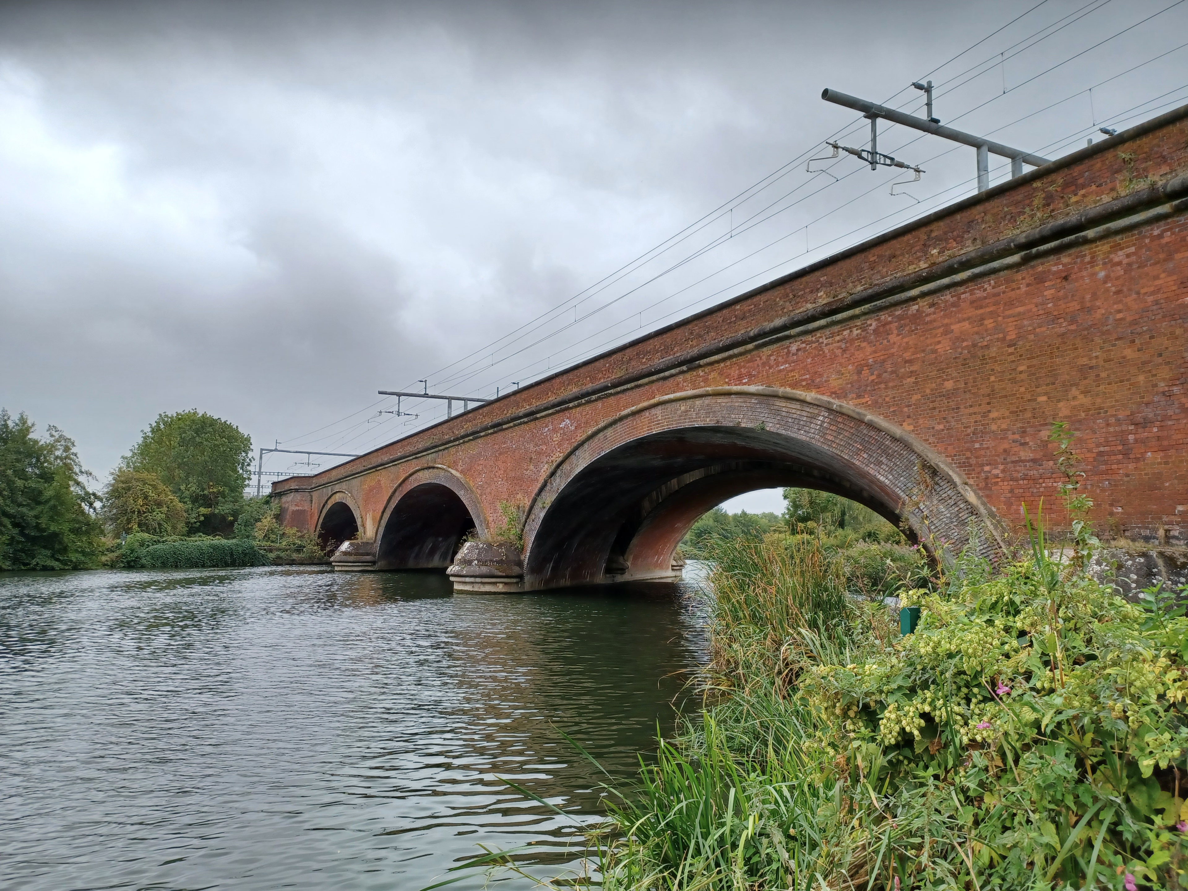
Moulsford Railway Bridge
Moulsford, United Kingdom
Moulsford Railway Bridge, also known locally as "Four Arches" bridge, is a pair of parallel bridges located a little to the north of Moulsford and South Stoke in Oxfordshire, UK. It carries the Great Western Main Line from Paddington, London to Wales and the West across the River Thames. The bridge lies between the stations at Goring & Streatley and Cholsey, and crosses the Thames at an oblique angle on the reach between Cleeve Lock and Benson Lock. The original Moulsford Railway Bridge was built between 1838 and 1840, having been designed by Isambard Kingdom Brunel for the main trunk route of the Great Western Railway. Built to carry a pair of broad gauge tracks across the Thames, it consists of four low semi-elliptical arches spanning the Thames at a considerably skewed angle of 60 degrees. During the 1890s, a second bridge was built immediately parallel to the original structure, enabling the railway to be expanded to a quadruple track configuration. The bridge was subsequently recognised as a Grade II* listed structure. The lines across the structure were electrified during the 2010s.
- Category
- Photo Spots
- Location
- Moulsford, United Kingdom
- Coordinates
- 51.55820, -1.14257
- How to get there
- Google MapsApple MapsOpenStreetMap
- Wikidata
- Q13528022
What is Moulsford Railway Bridge?
Moulsford Railway Bridge is a Photo Spots place on VeroMaps. Other places close by: Beetle and Wedge, Wallingford Castle, Gatehampton Railway Bridge, Bear at Home.
Where is Moulsford Railway Bridge?
Moulsford Railway Bridge is in Moulsford, United Kingdom. Coordinates: 51.55820, -1.14257.
How do I get to Moulsford Railway Bridge?
Moulsford Railway Bridge is at Moulsford, United Kingdom (51.55820, -1.14257). Enter these coordinates in Google Maps, Apple Maps or OpenStreetMap for walking, cycling or driving directions.