Forgotten History
Den Hoet
Utrecht, Netherlands
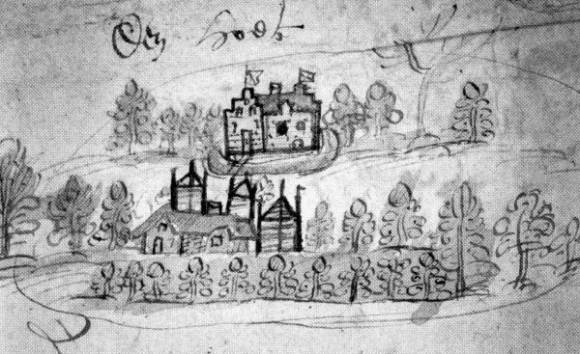
Den Hoet was a fortified house from the Middle Ages on the road between Utrecht and Vleuten. It lay in a loop of the now disappeared River Rhine. The site on which it was located has been preserved. The still existing entrance gate, which dates from the 16th century, is a national monument.
- Category
- Forgotten History
- Location
- Utrecht, Netherlands
- Coordinates
- 52.09855, 5.05801
- How to get there
- Google MapsApple MapsOpenStreetMap
- Wikidata
- Q2691048
What is Den Hoet?
Den Hoet is a Forgotten History place on VeroMaps. Other places close by: Hof ter Weiden, Werkspoorhavenbrug, Huis te Voorn, Metaal Kathedraal, Utrecht.
Where is Den Hoet?
Den Hoet is in Utrecht, Netherlands. Coordinates: 52.09855, 5.05801.
How do I get to Den Hoet?
Den Hoet is at Utrecht, Netherlands (52.09855, 5.05801). Enter these coordinates in Google Maps, Apple Maps or OpenStreetMap for walking, cycling or driving directions.