Forgotten History
Kilclief Castle
Portaferry, United Kingdom
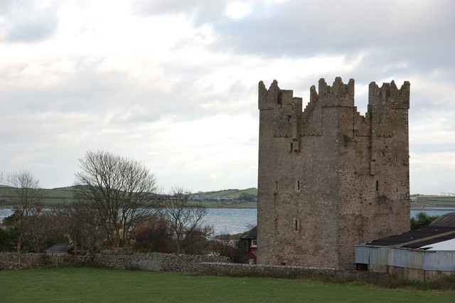
Kilclief Castle (Irish: Caislean Cill Cléithe; Ordnance Survey ref: J597457) is a tower-house castle beside Strangford Lough and 2.5 miles (4 km) south of the village of Strangford, County Down, Northern Ireland. Kilclief is a hamlet on the Strangford to Ardglass road.
- Category
- Forgotten History
- Location
- Portaferry, United Kingdom
- Coordinates
- 54.32800, -5.55400
- How to get there
- Google MapsApple MapsOpenStreetMap
- Wikidata
- Q3312062
What is Kilclief Castle?
Kilclief Castle is a Forgotten History place on VeroMaps. Other places close by: Angus Rock Lighthouse, Audley's Castle, Jordan's Castle, Bright Castle.
Where is Kilclief Castle?
Kilclief Castle is in Portaferry, United Kingdom. Coordinates: 54.32800, -5.55400.
How do I get to Kilclief Castle?
Kilclief Castle is at Portaferry, United Kingdom (54.32800, -5.55400). Enter these coordinates in Google Maps, Apple Maps or OpenStreetMap for walking, cycling or driving directions.