Forgotten History
Dundrum Castle
Dundrum, United Kingdom
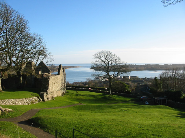
Dundrum Castle, a ruin standing over the town of Dundrum, County Down, Northern Ireland. It was constructed by John de Courcy, sometime near the beginning of the 13th century, following his invasion of Ulster. The castle, built to control access into Lecale from the west and south, stands on the top of a rocky hill commanding fine views south over Dundrum Bay and the Mourne Mountains, the lands west towards Slieve Croob and the plains of Lecale to the east. The Castle is a State Care Historic Monument in the townland of Dundrum, in Newry, Mourne and Down District Council area, at grid ref: J4047 3700.
- Category
- Forgotten History
- Location
- Dundrum, United Kingdom
- Coordinates
- 54.25660, -5.87400
- How to get there
- Google MapsApple MapsOpenStreetMap
- Wikidata
- Q4185827
What is Dundrum Castle?
Dundrum Castle is a Forgotten History place on VeroMaps. Other places close by: Clough Castle, Annadorn Dolmen, Legananny Dolmen, Bright Castle.
Where is Dundrum Castle?
Dundrum Castle is in Dundrum, United Kingdom. Coordinates: 54.25660, -5.87400.
How do I get to Dundrum Castle?
Dundrum Castle is at Dundrum, United Kingdom (54.25660, -5.87400). Enter these coordinates in Google Maps, Apple Maps or OpenStreetMap for walking, cycling or driving directions.