Forgotten History
Audley's Castle
Portaferry, United Kingdom
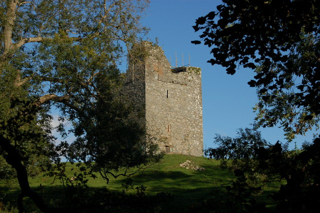
Audley's Castle is a 15th-century castle located 1 mile (1.6 km) north-east of Strangford, County Down, Northern Ireland, on a rocky height overlooking Strangford Lough. It is a three-storey Tower house named after its 16th century owner, John Audley. Audley's Castle tower house and bawn is a State Care Historic Monument in the townland of Castleward, in Down District Council area, at grid ref: J5781 5058. There are thousands of small stone towers similar to Audley's Castle in the Irish countryside. They are one of the commonest of archaeological sites, which indicates these were not buildings put up for the higher aristocracy, but for lesser lords and gentry. Most were built in the late Middle Ages (roughly 1350–1550). Audley's was built towards the end of this period.
- Category
- Forgotten History
- Location
- Portaferry, United Kingdom
- Coordinates
- 54.37960, -5.57194
- How to get there
- Google MapsApple MapsOpenStreetMap
- Wikidata
- Q4820045
What is Audley's Castle?
Audley's Castle is a Forgotten History place on VeroMaps. Other places close by: Kilclief Castle, Angus Rock Lighthouse, Jordan's Castle, Bright Castle.
Where is Audley's Castle?
Audley's Castle is in Portaferry, United Kingdom. Coordinates: 54.37960, -5.57194.
How do I get to Audley's Castle?
Audley's Castle is at Portaferry, United Kingdom (54.37960, -5.57194). Enter these coordinates in Google Maps, Apple Maps or OpenStreetMap for walking, cycling or driving directions.