Forgotten History
Kasteel Rozenhouthof
Sint-Katelijne-Waver, Belgium
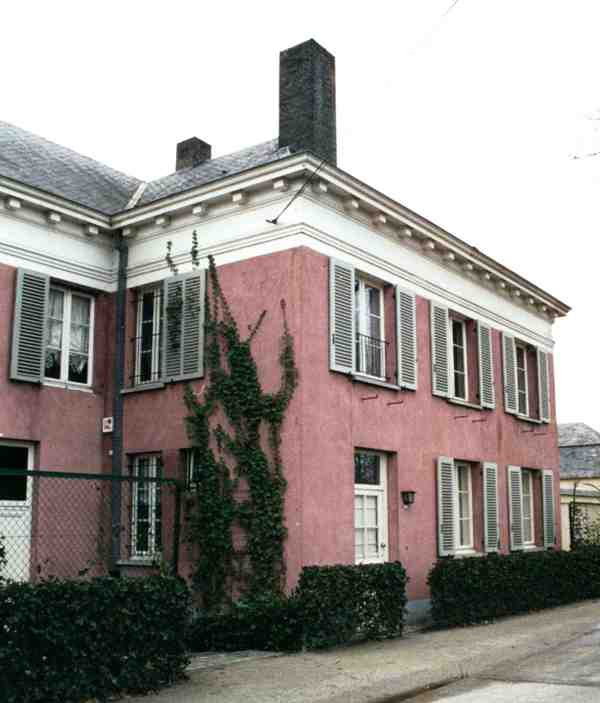
Castle Rozenhouthof is a castle in Elzestraat, a town belonging to the Antwerp municipality of Sint-Katelijne-Waver, located at Kuikenstraat 21-23. It concerns a 19th-century small castle in neoclassical style with wall-plane facades, which has undergone several alterations. Furthermore, a service building can be found on the estate. The western service buildings were demolished and replaced in 1995 by two small pavilions.
- Category
- Forgotten History
- Location
- Sint-Katelijne-Waver, Belgium
- Coordinates
- 51.06832, 4.47534
- How to get there
- Google MapsApple MapsOpenStreetMap
- Wikidata
- Q116170616
What is Kasteel Rozenhouthof?
Kasteel Rozenhouthof is a Forgotten History place on VeroMaps. Other places close by: Fort van Walem, Fort van Duffel, Kasteel Zorgvliet (Sint-Katelijne-Waver), Fort van Sint-Katelijne-Waver.
Where is Kasteel Rozenhouthof?
Kasteel Rozenhouthof is in Sint-Katelijne-Waver, Belgium. Coordinates: 51.06832, 4.47534.
How do I get to Kasteel Rozenhouthof?
Kasteel Rozenhouthof is at Sint-Katelijne-Waver, Belgium (51.06832, 4.47534). Enter these coordinates in Google Maps, Apple Maps or OpenStreetMap for walking, cycling or driving directions.