Photo corners
Gowy Meadows Nature Reserve
Manchester, United Kingdom
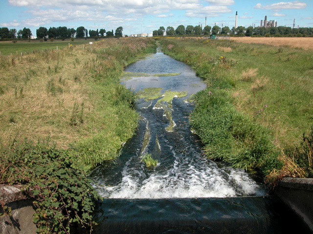
Gowy Meadows Nature Reserve is a 165.8-hectare (410-acre) nature reserve near Ellesmere Port, Cheshire, England. It consists of low-lying meadows immediately to the east of the River Gowy near its confluence with the River Mersey, south of Stanlow Oil Refinery and west of the village of Thornton-le-Moors (from where a public footpath follows Thornton Brook across the site). It is managed by the Cheshire Wildlife Trust on behalf of the landowner, Shell UK, and was founded in 2002. The M56 motorway runs along the southern edge of the reserve. The reserve consists mainly of low-lying wet pasture divided by ditches. It is part of the Gowy & Mersey Washlands Living Landscape initiative. Before the construction of the Manchester Ship Canal the Gowy would have been tidal in this area and much of the reserve would have consisted of saltmarsh with brackish creeks, whose traces can still be seen in places.
- Category
- Photo Spots
- Location
- Manchester, United Kingdom
- Coordinates
- 53.26040, -2.84770
- How to get there
- Google MapsApple MapsOpenStreetMap
- Wikidata
- Q5590147
What is Gowy Meadows Nature Reserve?
Gowy Meadows Nature Reserve is a Photo Spots place on VeroMaps. Other places close by: Rake Hall, Ince Manor, St. Plegmund's well, Alvanley Hall.
Where is Gowy Meadows Nature Reserve?
Gowy Meadows Nature Reserve is in Manchester, United Kingdom. Coordinates: 53.26040, -2.84770.
How do I get to Gowy Meadows Nature Reserve?
Gowy Meadows Nature Reserve is at Manchester, United Kingdom (53.26040, -2.84770). Enter these coordinates in Google Maps, Apple Maps or OpenStreetMap for walking, cycling or driving directions.