Urbex & Abandoned
Dode
Snodland, United Kingdom
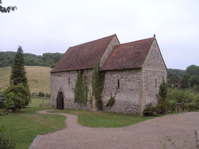
Dode (in Old English, Dowde) was a village in England that was wiped out by the Black Death in 1349. All that remains is the deconsecrated church, which was rebuilt in the 1990s.
- Category
- Urbex & Abandoned
- Location
- Snodland, United Kingdom
- Coordinates
- 51.34820, 0.39491
- How to get there
- Google MapsApple MapsOpenStreetMap
- Wikidata
- Q5287799
What is Dode?
Dode is a Urbex & Abandoned place on VeroMaps. Other places close by: Ranscombe Farm, Burham Down, Coffin Stone, Gads Hill Place.
Where is Dode?
Dode is in Snodland, United Kingdom. Coordinates: 51.34820, 0.39491.
How do I get to Dode?
Dode is at Snodland, United Kingdom (51.34820, 0.39491). Enter these coordinates in Google Maps, Apple Maps or OpenStreetMap for walking, cycling or driving directions.