Urbex & Abandoned
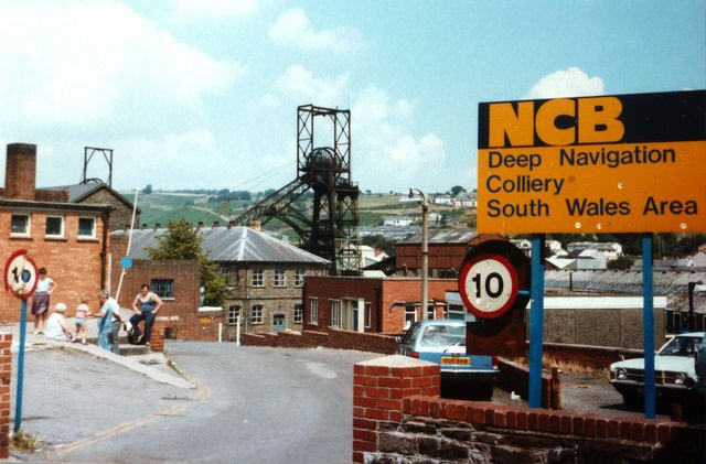
Deep Navigation Colliery
Treharris, United Kingdom
Deep Navigation Colliery was a coal mine in South Wales, that operated from 1872 until 1991. Located next to the co-developed village of Treharris in the borough of Merthyr Tydfil, on development it was the deepest coalmine in South Wales Coalfield by some 200 yards (180 m).
- Category
- Urbex & Abandoned
- Location
- Treharris, United Kingdom
- Coordinates
- 51.66780, -3.30075
- How to get there
- Google MapsApple MapsOpenStreetMap
- Wikidata
- Q5250242
What is Deep Navigation Colliery?
Deep Navigation Colliery is a Urbex & Abandoned place on VeroMaps. Other places close by: Albion Colliery, Penallta Colliery, Great Western Mine, Ffos-y-fran Land Reclamation Scheme.
Where is Deep Navigation Colliery?
Deep Navigation Colliery is in Treharris, United Kingdom. Coordinates: 51.66780, -3.30075.
How do I get to Deep Navigation Colliery?
Deep Navigation Colliery is at Treharris, United Kingdom (51.66780, -3.30075). Enter these coordinates in Google Maps, Apple Maps or OpenStreetMap for walking, cycling or driving directions.