Photo corners
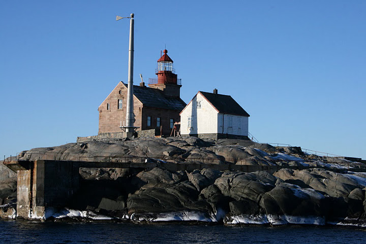
Torbjørnskjær Lighthouse
Skjaerhalden, Norway
Torbjørnskjær Lighthouse (Norwegian: Torbjørnskjær fyr, Urban East Norwegian: [ˈtʊ̂rbjøːɳʂæːr ˈfyːr]) is a fully automated coastal lighthouse situated on a skerry in the archipelago of Hvaler Municipality in Norway. It marks the east side of the entrance to the Oslofjord, with Færder Lighthouse marking the west side. The light is powered by solar power. Landing conditions are very difficult, and nowadays service calls are made via helicopter. The lighthouse and surrounding buildings, which include residences, outhouse, a well, and engine house are proposed protected as a national park.
- Category
- Photo Spots
- Location
- Skjaerhalden, Norway
- Coordinates
- 58.99598, 10.78248
- How to get there
- Google MapsApple MapsOpenStreetMap
- Wikidata
- Q3428706
What is Torbjørnskjær Lighthouse?
Torbjørnskjær Lighthouse is a Photo Spots place on VeroMaps. Other places close by: Ytre Hvaler National Park, Struten Lighthouse, Færder Lighthouse, Store Færder Lighthouse.
Where is Torbjørnskjær Lighthouse?
Torbjørnskjær Lighthouse is in Skjaerhalden, Norway. Coordinates: 58.99598, 10.78248.
How do I get to Torbjørnskjær Lighthouse?
Torbjørnskjær Lighthouse is at Skjaerhalden, Norway (58.99598, 10.78248). Enter these coordinates in Google Maps, Apple Maps or OpenStreetMap for walking, cycling or driving directions.