Photo corners
Stabbursdalen National Park
Hammerfest, Norway
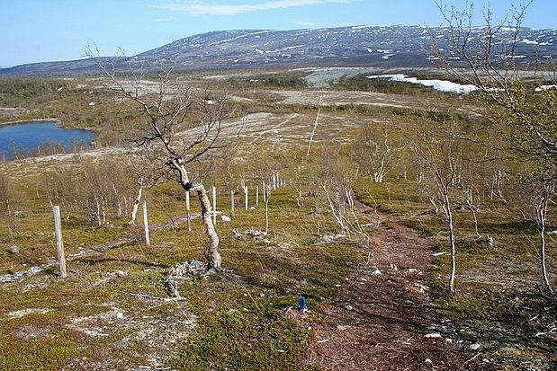
Stabbursdalen National Park (Norwegian: Stabbursdalen nasjonalpark or Northern Sami: Rávttošvuomi álbmotmeahcci) is a national park in North Norway. It contains the northernmost pine forest in the world. It is located in Porsanger Municipality in Finnmark county, Norway. The park surrounds the Stabburselva river and its surrounding valley, just west of the large Porsangerfjorden. A small corner of the park extends into neighboring Hammerfest Municipality.
- Category
- Photo Spots
- Location
- Hammerfest, Norway
- Coordinates
- 69.98333, 24.48333
- How to get there
- Google MapsApple MapsOpenStreetMap
- Wikidata
- Q1472424
What is Stabbursdalen National Park?
Stabbursdalen National Park is a Photo Spots place on VeroMaps. Other places close by: Fuglenes Lighthouse, Anárjohka National Park, Gjesværstappan.
Where is Stabbursdalen National Park?
Stabbursdalen National Park is in Hammerfest, Norway. Coordinates: 69.98333, 24.48333.
How do I get to Stabbursdalen National Park?
Stabbursdalen National Park is at Hammerfest, Norway (69.98333, 24.48333). Enter these coordinates in Google Maps, Apple Maps or OpenStreetMap for walking, cycling or driving directions.