Photo corners
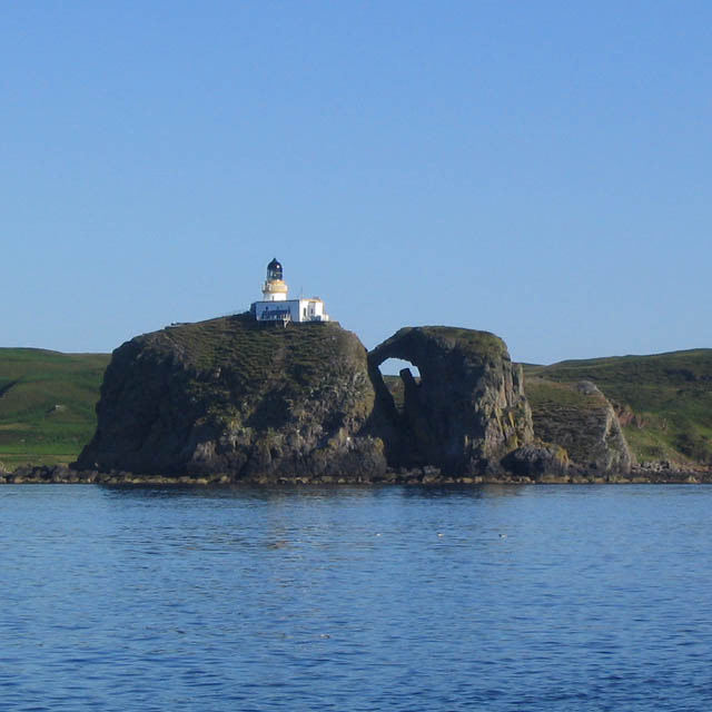
Sanda Island Lighthouse
Campbeltown, United Kingdom
The Sanda Island Lighthouse is a lighthouse on Sanda Island, Argyll and Bute, United Kingdom. One of the thirteen major lighthouses designed and built by Alan Stevenson, the lighthouse was established in 1850, after a series of shipwrecks in the area. The three "steps" of the lighthouse were due to the cliff on which it was built, and remain a unique design in Scotland. Automated in 1991, the lighthouse is operated by the Northern Lighthouse Board, and designated a Category A listed building.
- Category
- Photo Spots
- Location
- Campbeltown, United Kingdom
- Coordinates
- 55.27482, -5.58284
- How to get there
- Google MapsApple MapsOpenStreetMap
- Wikidata
- Q26132872
What is Sanda Island Lighthouse?
Sanda Island Lighthouse is a Photo Spots place on VeroMaps. Other places close by: Mull of Kintyre Lighthouse, Glenlussa Lodge, standing stone, Saddell Castle, Ailsa Craig Lighthouse.
Where is Sanda Island Lighthouse?
Sanda Island Lighthouse is in Campbeltown, United Kingdom. Coordinates: 55.27482, -5.58284.
How do I get to Sanda Island Lighthouse?
Sanda Island Lighthouse is at Campbeltown, United Kingdom (55.27482, -5.58284). Enter these coordinates in Google Maps, Apple Maps or OpenStreetMap for walking, cycling or driving directions.