Photo corners
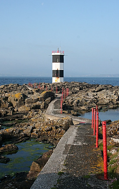
Rue Point Lighthouse
Co. Antrim, United Kingdom
Le phare de Rue Point est un phare situé au sud de l'Île de Rathlin, dans le Canal du Nord, au large de la côte du comté d'Antrim (Irlande du Nord) et de l'Écosse. Il est géré par les Commissioners of Irish Lights (CIL).
- Category
- Photo Spots
- Location
- Co. Antrim, United Kingdom
- Address
- South Light, Co. Antrim
- Coordinates
- 55.25870, -6.19110
- How to get there
- Google MapsApple MapsOpenStreetMap
- Wikidata
- Q28496367
What is Rue Point Lighthouse?
Rue Point Lighthouse is a Photo Spots place on VeroMaps, on South Light. Other places close by: East Lighthouse, Rathlin Island, Kinbane Castle, Rathlin West Lighthouse, Carra Castle.
Where is Rue Point Lighthouse?
Rue Point Lighthouse is in Co. Antrim, United Kingdom. Coordinates: 55.25870, -6.19110.
How do I get to Rue Point Lighthouse?
Rue Point Lighthouse is at South Light, Co. Antrim, United Kingdom (55.25870, -6.19110). Enter these coordinates in Google Maps, Apple Maps or OpenStreetMap for walking, cycling or driving directions.