Photo corners
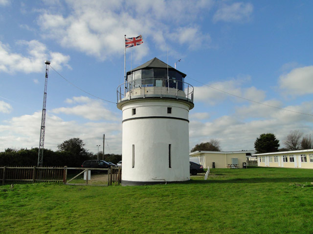
Pakefield Lighthouse
Kessingland, United Kingdom
Pakefield Lighthouse is a decommissioned 19th century lighthouse which was built near Pakefield a suburb of Lowestoft in Suffolk. The lighthouse tower has been used for a variety of maritime, civilian and military roles, and is currently used as a Coastwatch (now independent) coastal surveillance station.
- Category
- Photo Spots
- Location
- Kessingland, United Kingdom
- Coordinates
- 52.43700, 1.72930
- How to get there
- Google MapsApple MapsOpenStreetMap
- Wikidata
- Q21061715
What is Pakefield Lighthouse?
Pakefield Lighthouse is a Photo Spots place on VeroMaps. Other places close by: Lowestoft Lighthouse, Gunton Meadow, Reydon Wood, Southwold lighthouse.
Where is Pakefield Lighthouse?
Pakefield Lighthouse is in Kessingland, United Kingdom. Coordinates: 52.43700, 1.72930.
How do I get to Pakefield Lighthouse?
Pakefield Lighthouse is at Kessingland, United Kingdom (52.43700, 1.72930). Enter these coordinates in Google Maps, Apple Maps or OpenStreetMap for walking, cycling or driving directions.