Restaurants
Oxford Arms
London, United Kingdom
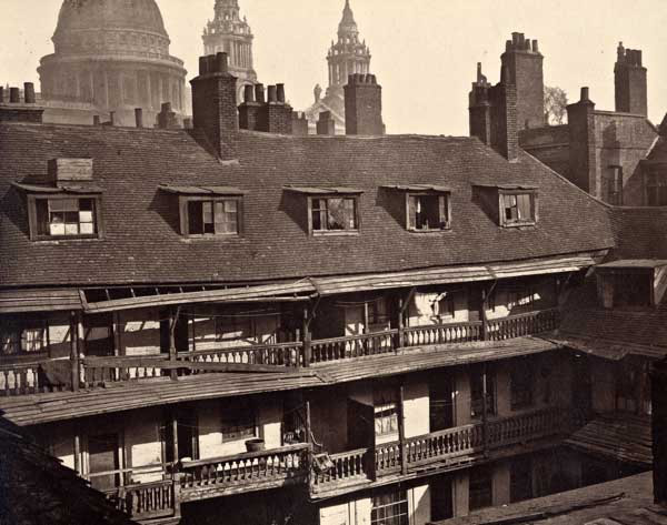
The Oxford Arms in Warwick Lane was one of the last surviving galleried coaching inns in London. It stood near St Paul's Cathedral between the 17th and late 19th centuries. It was built in the seventeenth century, before being rebuilt and extended after the Great Fire.
- Category
- Restaurants
- Location
- London, United Kingdom
- Coordinates
- 51.51480, -0.10130
- How to get there
- Google MapsApple MapsOpenStreetMap
- Wikidata
- Q21585408
What is Oxford Arms?
Oxford Arms is a Restaurants place on VeroMaps. Other places close by: Montfichet's Tower, Statue of Queen Anne, Viaduct Tavern, Belle Sauvage (inn).
Where is Oxford Arms?
Oxford Arms is in London, United Kingdom. Coordinates: 51.51480, -0.10130.
How do I get to Oxford Arms?
Oxford Arms is at London, United Kingdom (51.51480, -0.10130). Enter these coordinates in Google Maps, Apple Maps or OpenStreetMap for walking, cycling or driving directions.