Photo corners
Neidpath Viaduct
Scottish Borders, United Kingdom
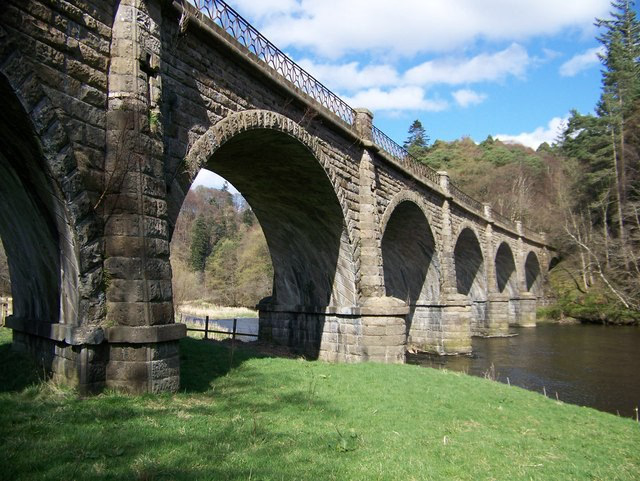
Neidpath Viaduct, occasionally known as the Queen's Bridge, consists of eight stone skew arches and was built to carry the Symington to Peebles branch line of the Caledonian Railway over the River Tweed to the south-west of Neidpath Castle. Now closed to rail traffic the bridge is used as a footpath.
- Category
- Photo Spots
- Location
- Scottish Borders, United Kingdom
- Coordinates
- 55.64921, -3.22062
- How to get there
- Google MapsApple MapsOpenStreetMap
- Wikidata
- Q6987987
What is Neidpath Viaduct?
Neidpath Viaduct is a Photo Spots place on VeroMaps. Other places close by: Drochil Castle, Dawyck Botanic Garden, Old Harestanes,stone circle 180m NE of, Crook Inn.
Where is Neidpath Viaduct?
Neidpath Viaduct is in Scottish Borders, United Kingdom. Coordinates: 55.64921, -3.22062.
How do I get to Neidpath Viaduct?
Neidpath Viaduct is at Scottish Borders, United Kingdom (55.64921, -3.22062). Enter these coordinates in Google Maps, Apple Maps or OpenStreetMap for walking, cycling or driving directions.