Urbex & Abandoned
Moghane Hillfort
Ireland
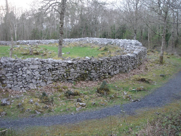
Moghane Hillfort (auch Mooghaun, irisch An Múchán) im County Clare ist die größte bronzezeitliche (1260–930 v. Chr. ) Hügelbefestigung in Irland. Moghane befindet sich etwa. 1,5 km nordöstlich von Newmarket-on-Fergus. Von der Aussichtsplattform auf dem Gipfel hat man einen weiten Blick über das Ästuar des River Fergus.
- Category
- Urbex & Abandoned
- Location
- Ireland
- Coordinates
- 52.77722, -8.88639
- How to get there
- Google MapsApple MapsOpenStreetMap
- Wikidata
- Q1796002
What is Moghane Hillfort?
Moghane Hillfort is a Urbex & Abandoned place on VeroMaps. Other places close by: Dromoland Castle, Ballycar Castle, Magh Adhair, Bunratty Castle.
Where is Moghane Hillfort?
Moghane Hillfort is in Ireland. Coordinates: 52.77722, -8.88639.
How do I get to Moghane Hillfort?
Moghane Hillfort is at Ireland (52.77722, -8.88639). Enter these coordinates in Google Maps, Apple Maps or OpenStreetMap for walking, cycling or driving directions.