Photo corners
Killerton
Exeter EX5 3LE, United Kingdom
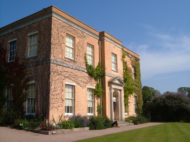
Killerton is an 18th-century house in Broadclyst, Exeter, Devon, England, which, with its hillside garden and estate, has been owned by the National Trust since 1944 and is open to the public. The National Trust displays the house as a comfortable home. On display in the house is a collection of 18th- to 20th-century costumes, originally known as the Paulise de Bush collection, shown in period rooms. The estate covers some 2,590 hectares (25.9 km2, 6,400 acres). Included in the estate is a steep wooded hillside with the remains of an Iron Age hill fort on top of it, known as Dolbury, which has also yielded evidence of Roman occupation, namely a triple-ditched Roman fort or marching camp which is still visible in aerial photographs, despite heavy ploughing within the hill fort. Killerton House itself and the Bear's Hut summerhouse in the grounds are Grade II* listed buildings. The gardens are Grade II* listed in the National Register of Historic Parks and Gardens.
- Category
- Photo Spots
- Location
- Exeter EX5 3LE, United Kingdom
- Address
- Broadclyst, Exeter EX5 3LE
- Coordinates
- 50.79130, -3.45773
- How to get there
- Google MapsApple MapsOpenStreetMap
- Wikidata
- Q6988604
What is Killerton?
Killerton is a Photo Spots place on VeroMaps, on Broadclyst. Other places close by: Dolbury, Bickleigh Castle, The Fisherman's Cot, George's Chapel, Exeter.
Where is Killerton?
Killerton is in Exeter EX5 3LE, United Kingdom. Coordinates: 50.79130, -3.45773.
How do I get to Killerton?
Killerton is at Broadclyst, Exeter EX5 3LE, United Kingdom (50.79130, -3.45773). Enter these coordinates in Google Maps, Apple Maps or OpenStreetMap for walking, cycling or driving directions.