Forgotten History
Kasteel de Hooge Vuursche
Baarn, Netherlands
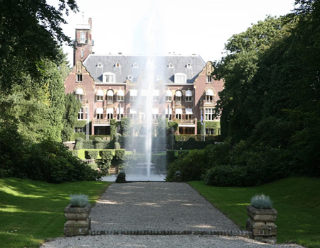
De Hooge Vuursche is an early 20th-century castle-like country house in the municipality of Baarn. It is not to be confused with the former 17th-century country house of the same name, probably demolished in 1815. That country house stood near the current exit to Lage Vuursche, on the north side of the Hilversumsestraatweg. The extensive forests between Baarn and Hilversum were owned in the 19th century by lady Louise Charlotte Rutgers van Rozenburg (1854 - 1908) and are known as the Hooge Vuursche.
- Category
- Forgotten History
- Location
- Baarn, Netherlands
- Address
- Hilversumsestraatweg 14, Baarn
- Coordinates
- 52.20361, 5.24639
- How to get there
- Google MapsApple MapsOpenStreetMap
- Wikidata
- Q2682802
What is Kasteel de Hooge Vuursche?
Kasteel de Hooge Vuursche is a Forgotten History place on VeroMaps, on Hilversumsestraatweg 14. Other places close by: Kasteel Groeneveld (Baarn), Watertoren, Soestdijk, Watertoren in Baarn, Bevrijdingsmonument Baarn.
Where is Kasteel de Hooge Vuursche?
Kasteel de Hooge Vuursche is in Baarn, Netherlands. Coordinates: 52.20361, 5.24639.
How do I get to Kasteel de Hooge Vuursche?
Kasteel de Hooge Vuursche is at Hilversumsestraatweg 14, Baarn, Netherlands (52.20361, 5.24639). Enter these coordinates in Google Maps, Apple Maps or OpenStreetMap for walking, cycling or driving directions.