Photo corners
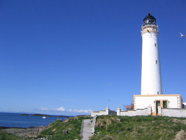
Hyskeir Lighthouse
Isle of Skye, United Kingdom
Hyskeir Lighthouse in Scotland was established in 1904. The 39-metre-high (128 ft) lighthouse marks the southern end of The Minch, warning of the presence of the Mills Rocks, Canna, and Hyskeir itself. It was designed by David and Charles Stevenson and constructed by Oban contractor Messrs D & J MacDougall. The white tower was staffed until March 1997, becoming one of the last lighthouses in Scotland to be automated. The keepers were briefly known for their one-hole golf course following their appearance on TV. Now controlled by the Northern Lighthouse Board in Edinburgh, it displays three white flashes every thirty seconds. Hyskeir and its lighthouse feature extensively in Peter Hill's 2003 book Stargazing: Memoirs of a Young Lighthouse Keeper.
- Category
- Photo Spots
- Location
- Isle of Skye, United Kingdom
- Coordinates
- 56.96898, -6.68085
- How to get there
- Google MapsApple MapsOpenStreetMap
- Wikidata
- Q15227367
What is Hyskeir Lighthouse?
Hyskeir Lighthouse is a Photo Spots place on VeroMaps. Other places close by: Dùn Dubh, Ardnamurchan Lighthouse, Totronald standing stones, Point of Sleat Lighthouse.
Where is Hyskeir Lighthouse?
Hyskeir Lighthouse is in Isle of Skye, United Kingdom. Coordinates: 56.96898, -6.68085.
How do I get to Hyskeir Lighthouse?
Hyskeir Lighthouse is at Isle of Skye, United Kingdom (56.96898, -6.68085). Enter these coordinates in Google Maps, Apple Maps or OpenStreetMap for walking, cycling or driving directions.