Forgotten History
Het Hoes
Voeren, Belgium
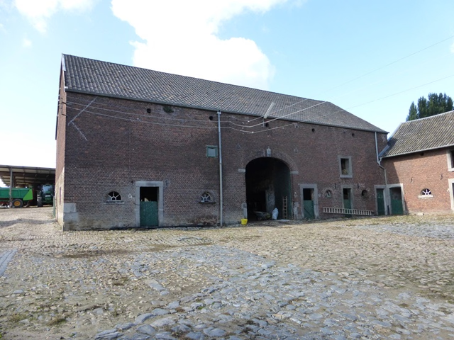
Het Hoes is the former castle of Remersdaal, located opposite the cemetery. The castle was demolished in the 19th century, but there are still remains, namely the entrance gate, the wall around the former castle, with corner towers and farm buildings, on which the year 1652 can be found. In this year the castle was rebuilt by Jan Hendrik van Eynatten, lord of Remersdaal.
- Category
- Forgotten History
- Location
- Voeren, Belgium
- Coordinates
- 50.73021, 5.87949
- How to get there
- Google MapsApple MapsOpenStreetMap
- Wikidata
- Q42293877
What is Het Hoes?
Het Hoes is a Forgotten History place on VeroMaps. Other places close by: Kasteel van Obsinnich, Abdij van Sinnich, Castle of Teuven, Moulins Meyers.
Where is Het Hoes?
Het Hoes is in Voeren, Belgium. Coordinates: 50.73021, 5.87949.
How do I get to Het Hoes?
Het Hoes is at Voeren, Belgium (50.73021, 5.87949). Enter these coordinates in Google Maps, Apple Maps or OpenStreetMap for walking, cycling or driving directions.