Forgotten History
Dunnottar Castle
Stonehaven, United Kingdom
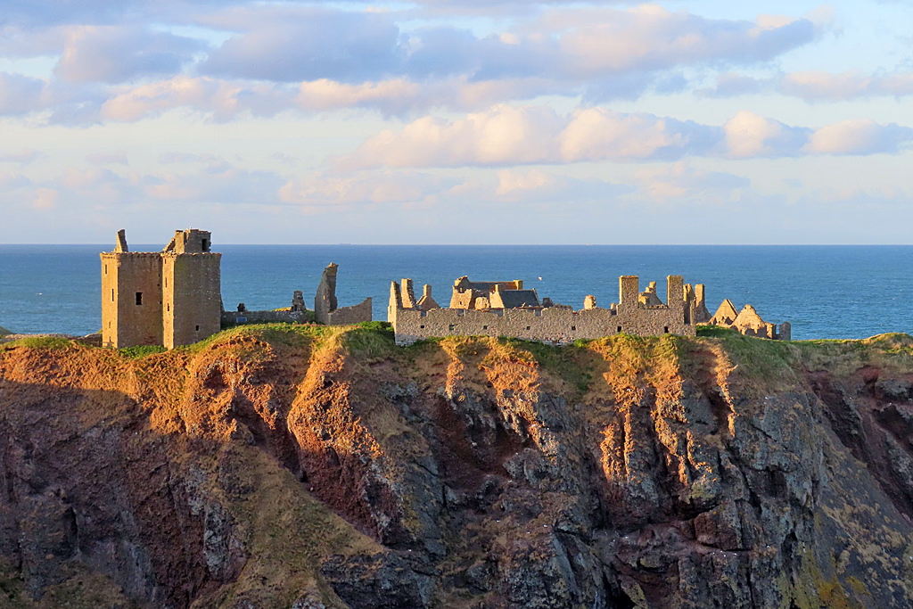
Dunnottar Castle (Scottish Gaelic: Dùn Fhoithear, "fort on the shelving slope") is a ruined medieval fortress located upon a rocky headland on the northeast coast of Scotland, about 2 miles (3 kilometres) south of Stonehaven in Aberdeenshire. The surviving buildings are largely of the 15th and 16th centuries, but the site is believed to have been fortified in the Early Middle Ages. Dunnottar has played a prominent role in the history of Scotland through to the 18th-century Jacobite risings because of its strategic location and defensive strength. Dunnottar is best known as the place where the Honours of Scotland, the Scottish crown jewels, were hidden from Oliver Cromwell's invading army in the 17th century. The property of the Keiths from the 14th century, and the seat of the Earl Marischal, Dunnottar declined after the last Earl forfeited his titles by taking part in the Jacobite rebellion of 1715. The castle was restored in the 20th century and is now open to the public. The castle ruins are spread over 1.4 hectares (3.5 acres), The site is surrounded by steep cliffs that drop to the North Sea, 160 feet (50 metres) below. A narrow strip of land joins the headland to the mainland, along which a steep path leads to the gatehouse. The various buildings in the castle include the 14th-century tower house as well as the 16th-century palace. Dunnottar Castle is a scheduled monument, and twelve structures on the site were listed buildings.
- Category
- Forgotten History
- Location
- Stonehaven, United Kingdom
- Coordinates
- 56.94569, -2.19677
- How to get there
- Google MapsApple MapsOpenStreetMap
- Wikidata
- Q746983
What is Dunnottar Castle?
Dunnottar Castle is a Forgotten History place on VeroMaps. Other places close by: Cowie Castle, Fetteresso Castle, Todhead Lighthouse, Lang Stane of Auquhollie.
Where is Dunnottar Castle?
Dunnottar Castle is in Stonehaven, United Kingdom. Coordinates: 56.94569, -2.19677.
How do I get to Dunnottar Castle?
Dunnottar Castle is at Stonehaven, United Kingdom (56.94569, -2.19677). Enter these coordinates in Google Maps, Apple Maps or OpenStreetMap for walking, cycling or driving directions.