Forgotten History
Castello di Riva
strada Comunale ‒ Riva ‒ Ponte dell'Olio (PC), Italy
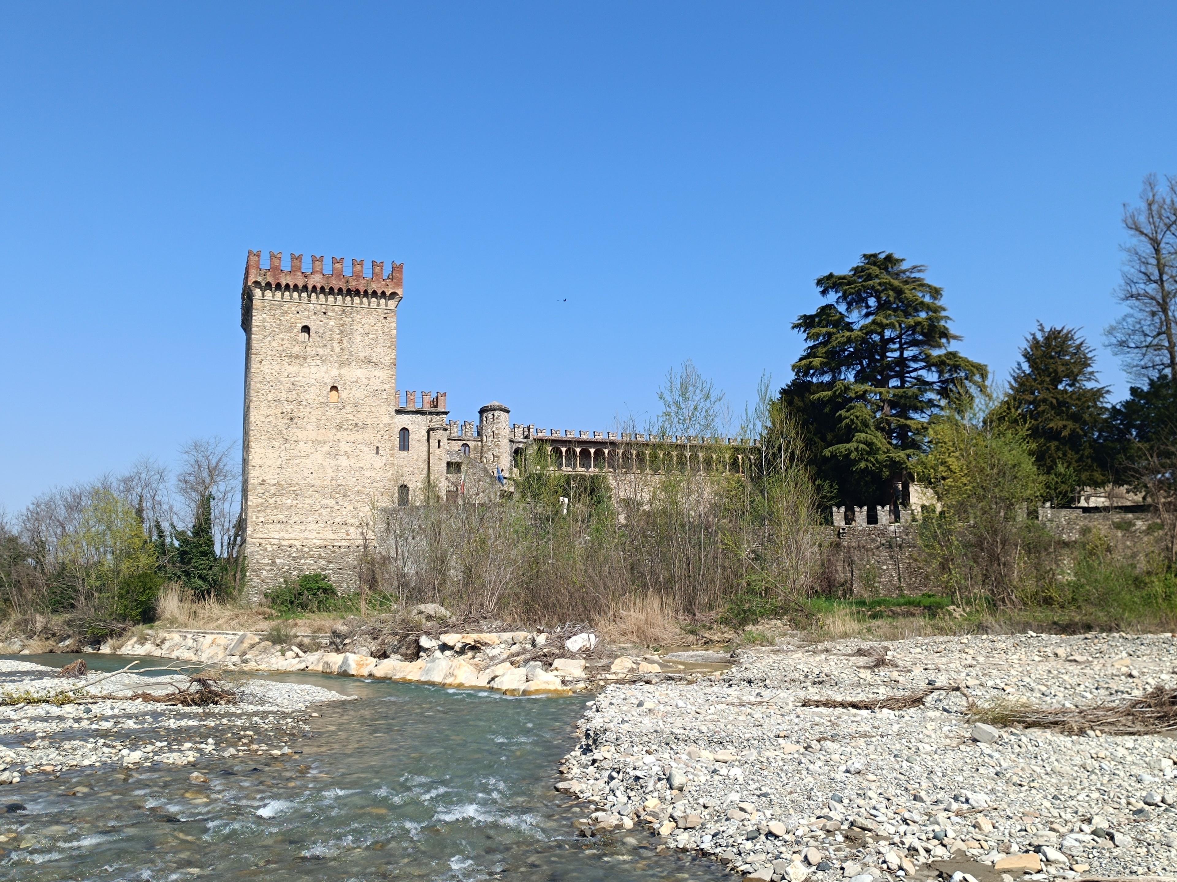
Das Castello di Riva ist eine mittelalterliche Burg in Riva, einem Ortsteil der Gemeinde Ponte dell’Olio in der italienischen Emilia-Romagna. Der Name der Burg leitet sich von dem Ortsteil ab, in dem sie steht; dieser wiederum erhielt den Namen „Riva“ (dt.: Ufer) vermutlich wegen des benachbarten Bachlaufes der Nure. Die Burg steht am orographisch rechten Ufer des Baches, zwischen dem Bachlauf und der Straße, die das Tal durchzieht, zur Kontrolle des Weges entlang des Nuretals. Ihre Lage nahe der Stelle, an der der Nure in die Poebene eintritt, war strategisch günstig, da sie die Kontrolle des Weges in Richtung Meer ermöglichte: Durch das Val d’Aveto in Richtung Ligurien und durch das Val di Taro in die Lunigiana.
- Category
- Forgotten History
- Location
- strada Comunale ‒ Riva ‒ Ponte dell'Olio (PC), Italy
- Coordinates
- 44.85739, 9.62887
- How to get there
- Google MapsApple MapsOpenStreetMap
- Wikidata
- Q3662834
What is Castello di Riva?
Castello di Riva is a Forgotten History place on VeroMaps. Other places close by: Castello di Montechiaro, Castello di Statto, Montechino Castle, Gropparello Castle.
Where is Castello di Riva?
Castello di Riva is in strada Comunale ‒ Riva ‒ Ponte dell'Olio (PC), Italy. Coordinates: 44.85739, 9.62887.
How do I get to Castello di Riva?
Castello di Riva is at strada Comunale ‒ Riva ‒ Ponte dell'Olio (PC), Italy (44.85739, 9.62887). Enter these coordinates in Google Maps, Apple Maps or OpenStreetMap for walking, cycling or driving directions.