Photo corners
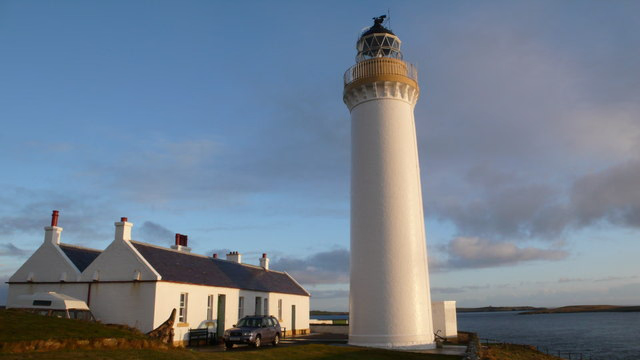
Cantick Head Lighthouse
Stromness, United Kingdom
The Cantick Head Lighthouse is an active 19th century lighthouse on the Scottish island of South Walls in the Orkney Islands. It is located at the end of Cantick Head, a long peninsula on the south-eastern coast of South Walls that overlooks the Pentland Firth and the Sound of Hoxa, which forms the southern entry to the natural harbour of Scapa Flow. South Walls is joined to the larger island of Hoy by a narrow causeway, allowing road access to the village of Longhope, Hackness and then the lighthouse further to the south-east.
- Category
- Photo Spots
- Location
- Stromness, United Kingdom
- Coordinates
- 58.78710, -3.13132
- How to get there
- Google MapsApple MapsOpenStreetMap
- Wikidata
- Q17829260
What is Cantick Head Lighthouse?
Cantick Head Lighthouse is a Photo Spots place on VeroMaps. Other places close by: Hoxa Head Lighthouse, Barrel of Butter lighthouse, Pentland Skerries High Light, Castle of Mey.
Where is Cantick Head Lighthouse?
Cantick Head Lighthouse is in Stromness, United Kingdom. Coordinates: 58.78710, -3.13132.
How do I get to Cantick Head Lighthouse?
Cantick Head Lighthouse is at Stromness, United Kingdom (58.78710, -3.13132). Enter these coordinates in Google Maps, Apple Maps or OpenStreetMap for walking, cycling or driving directions.