Photo corners
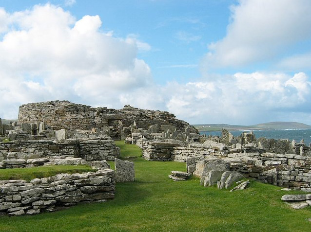
Broch of Gurness
Orkney Islands, United Kingdom
The Broch of Gurness is an Iron Age broch village on the northeast coast of Mainland Orkney in Scotland overlooking Eynhallow Sound, about 15 miles north-west of Kirkwall. It once housed a substantial community. It was discovered by the Orkney poet and naturalist Robert Rendall in 1929.
- Category
- Photo Spots
- Location
- Orkney Islands, United Kingdom
- Coordinates
- 59.12397, -3.08167
- How to get there
- Google MapsApple MapsOpenStreetMap
- Wikidata
- Q923355
What is Broch of Gurness?
Broch of Gurness is a Photo Spots place on VeroMaps. Other places close by: Long Stone, standing stone, Frotoft, Rousay, Stanerandy,mound and two standing stones, Earl's Palace, Buckquoy.
Where is Broch of Gurness?
Broch of Gurness is in Orkney Islands, United Kingdom. Coordinates: 59.12397, -3.08167.
How do I get to Broch of Gurness?
Broch of Gurness is at Orkney Islands, United Kingdom (59.12397, -3.08167). Enter these coordinates in Google Maps, Apple Maps or OpenStreetMap for walking, cycling or driving directions.