Photo corners
Cairngorms National Park
Aviemore, United Kingdom
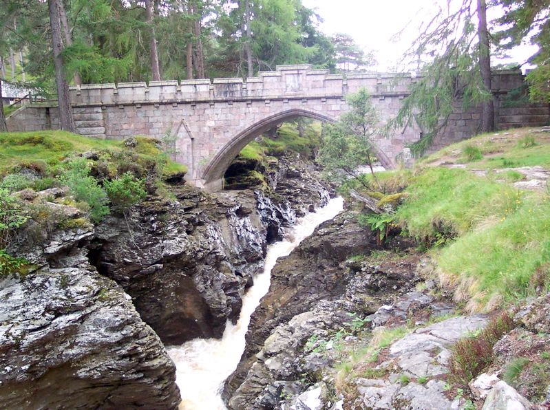
Cairngorms National Park (Scottish Gaelic: Pàirc Nàiseanta a' Mhonaidh Ruaidh) is a national park in northeast Scotland, established in 2003. It was the second of two national parks established by the Scottish Parliament, after Loch Lomond and The Trossachs National Park, which was set up in 2002. The park covers the Cairngorms range of mountains, and surrounding hills. Already the largest national park in the United Kingdom, in 2010 it was expanded into Perth and Kinross. Roughly 18,000 people live within the 4,528-square-kilometre (1,748 sq mi) national park. The largest communities are Aviemore, Ballater, Braemar, Grantown-on-Spey, Kingussie, Newtonmore and Tomintoul. Like all other national parks in the UK, the park is IUCN designated Category V. However, it contains within its boundaries several national nature reserves that have IUCN Category II (national park) statuses, such as Abernethy Forest and Mar Lodge Estate. In 2018, 1.9 million tourism visits were recorded. The majority of visitors are domestic, with 25 per cent coming from elsewhere in the UK, and 21 per cent being from other countries. Tourism makes up about 80% of the economy of the national park.
- Category
- Photo Spots
- Location
- Aviemore, United Kingdom
- Coordinates
- 57.08330, -3.66667
- How to get there
- Google MapsApple MapsOpenStreetMap
- Wikidata
- Q1025953
What is Cairngorms National Park?
Cairngorms National Park is a Photo Spots place on VeroMaps. Other places close by: Mar Lodge Estate, Braemar Castle, Auchgourish botanical garden, Corgarff Castle.
Where is Cairngorms National Park?
Cairngorms National Park is in Aviemore, United Kingdom. Coordinates: 57.08330, -3.66667.
How do I get to Cairngorms National Park?
Cairngorms National Park is at Aviemore, United Kingdom (57.08330, -3.66667). Enter these coordinates in Google Maps, Apple Maps or OpenStreetMap for walking, cycling or driving directions.