Photo corners
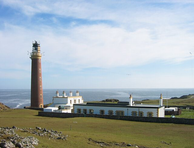
Butt of Lewis Lighthouse
Isle of Lewis, United Kingdom
Butt of Lewis Lighthouse, designed by David Stevenson, was built at Butt of Lewis to aid shipping in the 1860s. Unusual for a lighthouse in Scotland, it is constructed of red brick, and is unpainted. The station was automated in 1998, one of the last to be converted. A modern differential GPS base station has now been sited on a nearby hill to further aid navigation. This hill was also the site for a Lloyd's Signal Station from the 1890s. The road to the lighthouse passes a sheltered cove called Port Stoth. Agricultural lazy beds are also visible along the coast. The Butt of Lewis features some of the oldest rocks in Europe, having been formed in the Precambrian period up to 3 billion years ago. Following the coast southwest from the lighthouse there is a natural arch called the "Eye of the Butt" (Scottish Gaelic: Toll a’ Ròigh). It can be best viewed from the Habost machair.
- Category
- Photo Spots
- Location
- Isle of Lewis, United Kingdom
- Coordinates
- 58.51563, -6.26087
- How to get there
- Google MapsApple MapsOpenStreetMap
- Wikidata
- Q13630879
What is Butt of Lewis Lighthouse?
Butt of Lewis Lighthouse is a Photo Spots place on VeroMaps. Other places close by: Clach an Trushal, Arnish Point Lighthouse, Lewis, Callanish X, Callanish VIII.
Where is Butt of Lewis Lighthouse?
Butt of Lewis Lighthouse is in Isle of Lewis, United Kingdom. Coordinates: 58.51563, -6.26087.
How do I get to Butt of Lewis Lighthouse?
Butt of Lewis Lighthouse is at Isle of Lewis, United Kingdom (58.51563, -6.26087). Enter these coordinates in Google Maps, Apple Maps or OpenStreetMap for walking, cycling or driving directions.