Local Legends
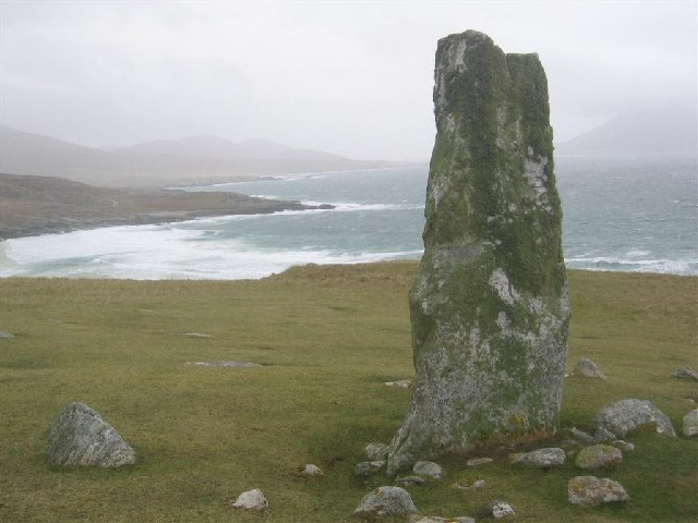
Clach Mhic Leòid
Harris, United Kingdom
Der Clach Mhic Leoid (auch Clach Mhicleoid; MacLeod’s Stone oder Nisabost genannt) ist ein Menhir (englisch Standing Stone) nördlich des 159 m hohen Cleit Niosaboist, bei Horgabost auf der Halbinsel Luskentyre, im Süden der Äußere-Hebriden-Insel Harris in Schottland.
- Category
- Local Legends
- Location
- Harris, United Kingdom
- Coordinates
- 57.86591, -6.99180
- How to get there
- Google MapsApple MapsOpenStreetMap
- Wikidata
- Q51075812
What is Clach Mhic Leòid?
Clach Mhic Leòid is a Local Legends place on VeroMaps. Other places close by: Clach An Teampuill, Rodel Hotel, Harris, Ardvourlie Castle, Eilean Glas Lighthouse.
Where is Clach Mhic Leòid?
Clach Mhic Leòid is in Harris, United Kingdom. Coordinates: 57.86591, -6.99180.
How do I get to Clach Mhic Leòid?
Clach Mhic Leòid is at Harris, United Kingdom (57.86591, -6.99180). Enter these coordinates in Google Maps, Apple Maps or OpenStreetMap for walking, cycling or driving directions.