Photo corners
Avery Rock Light
Washington County, United States
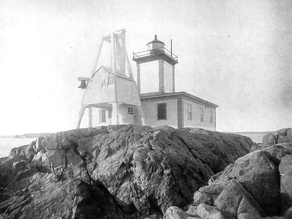
Avery Rock Light was a lighthouse in Avery Rock, Machias Bay, Maine, United States. It was built on a rocky islet, 110 metres long and 48 metres wide, in the middle of Machias Bay accessible only by boat. The old light was a square tower built in 1875 with a gallery and lantern centered on the keeper's house.
- Category
- Photo Spots
- Location
- Washington County, United States
- Coordinates
- 44.65444, -67.34417
- How to get there
- Google MapsApple MapsOpenStreetMap
- Wikidata
- Q790659
What is Avery Rock Light?
Avery Rock Light is a Photo Spots place on VeroMaps. Other places close by: West Quoddy Head Light, Mulholland Point Lighthouse, The Algonquin Resort, Havana.
Where is Avery Rock Light?
Avery Rock Light is in Washington County, United States. Coordinates: 44.65444, -67.34417.
How do I get to Avery Rock Light?
Avery Rock Light is at Washington County, United States (44.65444, -67.34417). Enter these coordinates in Google Maps, Apple Maps or OpenStreetMap for walking, cycling or driving directions.