Urbex & Abandoned
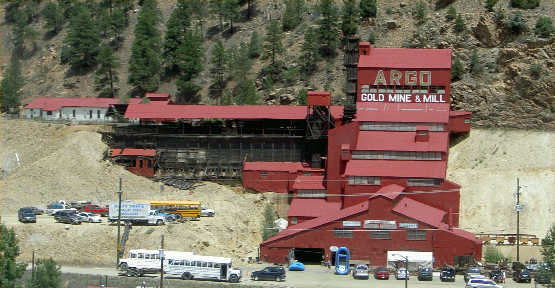
Argo Gold Mine and Mill
United States
The Argo Gold Mine and Mill is a former gold mining and milling property in Idaho Springs, Colorado, featuring an intact gold mill built at the entrance of the Argo Tunnel. The tunnel was built between 1893 and 1910 to drain the gold mines in Virginia Canyon, Gilpin Gulch, Russell Gulch, Quartz Hill, Nevadaville, and Central City and allow easier ore removal. The success of the tunnel as an access route meant that a large volume of ore began exiting at the Idaho Springs entrance and a large mill was built to process it. At the time it was one of the largest such tunnels and milling operations in the world, directly recovering nearly $100 million in gold (11.2 million ounces) valued in 2023 at $10.1 trillion. They also sent another $200 million of high-value ores to smelters in Denver. The property was closed in January 1943 after a major hydraulic accident in the tunnel, and never reopened after a federal moratorium was placed on gold mining during World War II. In 1976 it was purchased by a local investment group led by James N. Maxwell, who wanted to preserve an example of the Colorado gold rush mines. It was renovated and reopened as a tourist attraction and mining museum, and presently continues to offer daily tours. It was added to the National Register of Historic Places in January 1978.
- Category
- Urbex & Abandoned
- Location
- United States
- Address
- 2350 RIVERSIDE DR
- Coordinates
- 39.74290, -105.50700
- How to get there
- Google MapsApple MapsOpenStreetMap
- Wikidata
- Q4789626
What is Argo Gold Mine and Mill?
Argo Gold Mine and Mill is a Urbex & Abandoned place on VeroMaps, on 2350 RIVERSIDE DR. Other places close by: Winks Panorama, Red Rocks Amphitheatre, Henderson Mine, The Fort.
Where is Argo Gold Mine and Mill?
Argo Gold Mine and Mill is in United States. Coordinates: 39.74290, -105.50700.
How do I get to Argo Gold Mine and Mill?
Argo Gold Mine and Mill is at 2350 RIVERSIDE DR, United States (39.74290, -105.50700). Enter these coordinates in Google Maps, Apple Maps or OpenStreetMap for walking, cycling or driving directions.