Local Legends
Vela Spila
Vela Luka, Croatia
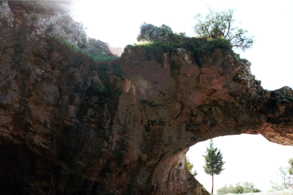
The Vela Spila cave (Croatian: Vela Spila, "Big Cave") is situated above the town of Vela Luka on the island of Korčula, in Croatia on Pinski Rat hill at an elevation of approximately 130 m (430 ft). The cave consists of an elliptically shaped cavern that measures 40 m (130 ft) in length, 17 m (56 ft) in height, and is approximately 40 m (130 ft) wide. There are, similar to the Brillenhöhle in Germany, two openings in the roof of the cave which were caused by collapse at an as yet undetermined time. Nikola Ostoić was the first person to describe the cave in modern literature. In 1856, he wrote "Compendio Storico Dell Isola Di Curzola". A local historian, museum commissioner, and collector of antiquities, he visited the cave in 1835. The cave has been mentioned in the Korčula Statute back in the 15th century.
- Category
- Local Legends
- Location
- Vela Luka, Croatia
- Coordinates
- 42.96973, 16.71836
- How to get there
- Google MapsApple MapsOpenStreetMap
- Wikidata
- Q3442384
What is Vela Spila?
Vela Spila is a Local Legends place on VeroMaps. Other places close by: Pokonji Dol Lighthouse, Drakonjina špilja, Sućuraj lighthouse, Sveti Petar Lighthouse.
Where is Vela Spila?
Vela Spila is in Vela Luka, Croatia. Coordinates: 42.96973, 16.71836.
How do I get to Vela Spila?
Vela Spila is at Vela Luka, Croatia (42.96973, 16.71836). Enter these coordinates in Google Maps, Apple Maps or OpenStreetMap for walking, cycling or driving directions.