Local Legends
Tumulus de Crugon
Pouldreuzic, France
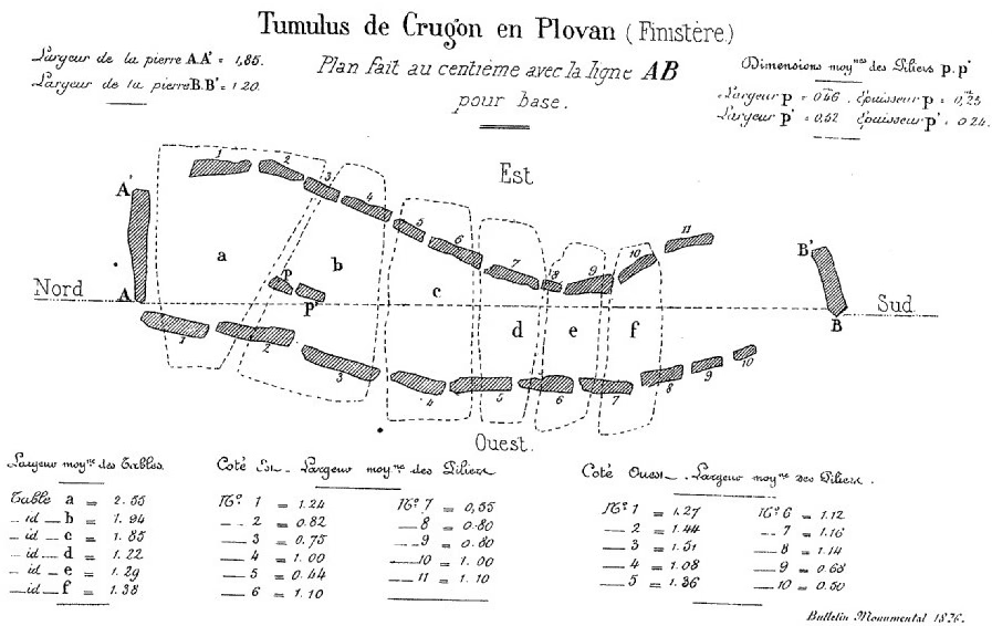
Im Jahre 1876 wurde der etwa 750 Meter vom Meer entfernte Tumulus von Crugon, in Renongar, nördlich von Plovan in der Cornouaille im Département Finistère in der Bretagne in Frankreich ausgegraben und der Steine, einer Allée couverte für den Bau einer Mühle beraubt.
- Category
- Local Legends
- Location
- Pouldreuzic, France
- Coordinates
- 47.93305, -4.37990
- How to get there
- Google MapsApple MapsOpenStreetMap
- Wikidata
- Q51075921
What is Tumulus de Crugon?
Tumulus de Crugon is a Local Legends place on VeroMaps. Other places close by: Chapelle de Languidou, Chapelle Saint-Philibert de Lanvern, Chapelle de Languivoa, Menez-Dregan.
Where is Tumulus de Crugon?
Tumulus de Crugon is in Pouldreuzic, France. Coordinates: 47.93305, -4.37990.
How do I get to Tumulus de Crugon?
Tumulus de Crugon is at Pouldreuzic, France (47.93305, -4.37990). Enter these coordinates in Google Maps, Apple Maps or OpenStreetMap for walking, cycling or driving directions.