Urbex & Abandoned
Siegenthal
Gmina Ustrzyki Dolne, Poland
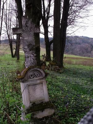
Siegenthal was a village (a colony) in the vicinity of what is now Brzegi Dolne, in the administrative district of Gmina Ustrzyki Dolne, within Bieszczady County, Subcarpathian Voivodeship, in south-eastern Poland. The settlement was established in the course of Josephine colonization by Lutheran Germans settlers in 1788.
- Category
- Urbex & Abandoned
- Location
- Gmina Ustrzyki Dolne, Poland
- Coordinates
- 49.46056, 22.63111
- How to get there
- Google MapsApple MapsOpenStreetMap
- Wikidata
- Q2283034
What is Siegenthal?
Siegenthal is a Urbex & Abandoned place on VeroMaps. Other places close by: Olszanica Palace, Lesko Castle, Sobień Castle, Castle in Bircza.
Where is Siegenthal?
Siegenthal is in Gmina Ustrzyki Dolne, Poland. Coordinates: 49.46056, 22.63111.
How do I get to Siegenthal?
Siegenthal is at Gmina Ustrzyki Dolne, Poland (49.46056, 22.63111). Enter these coordinates in Google Maps, Apple Maps or OpenStreetMap for walking, cycling or driving directions.