Forgotten History
San Esteban de Deyo
Villamayor de Monjardin, Spain
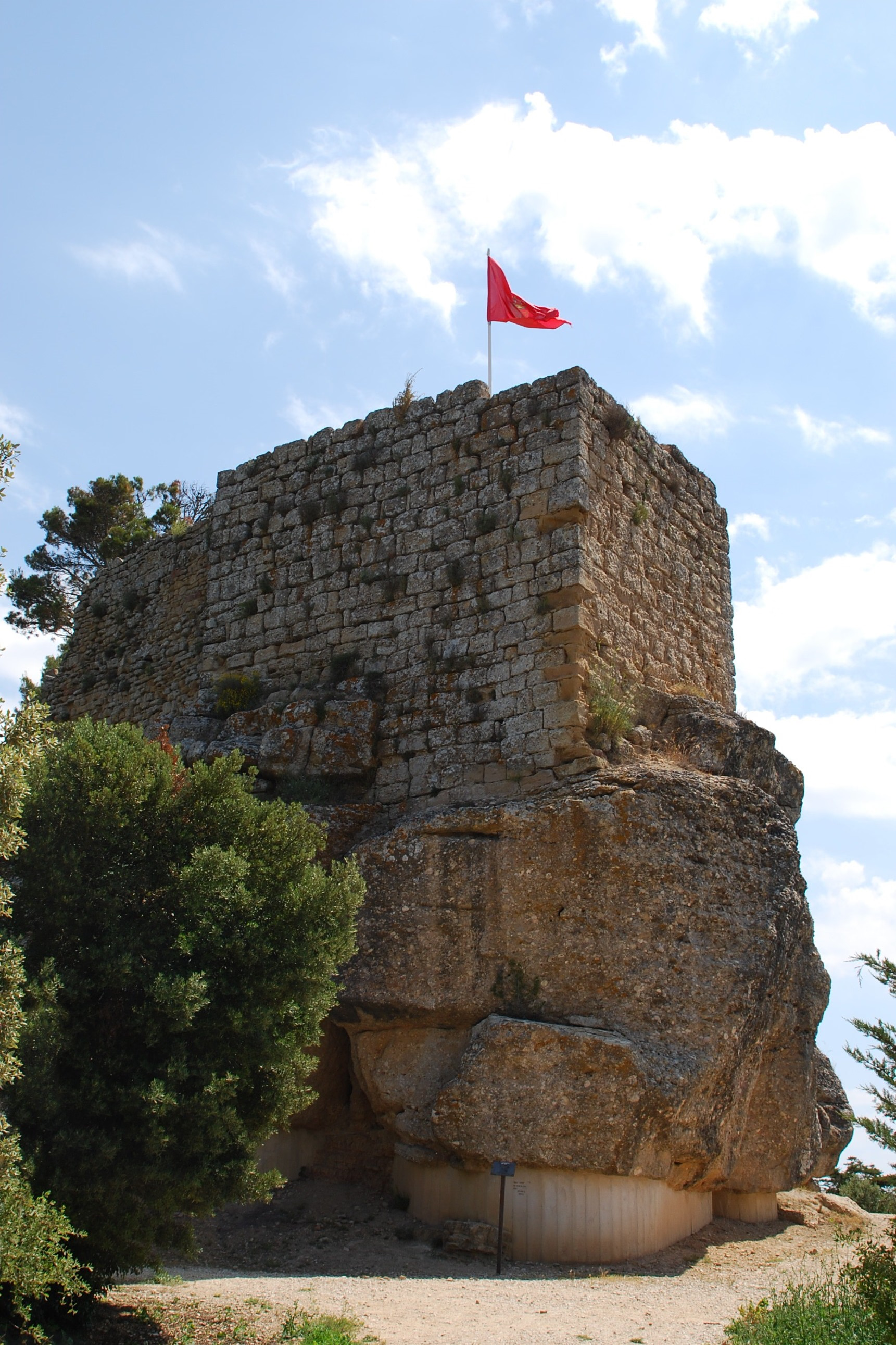
San Esteban de Deyo, also called the Castillo de Monjardín, is a ruined castle on a hill overlooking Villamayor de Monjardín in Navarre. The castle lies at an elevation of 890 metres. The castle has a Roman foundation, but was repeatedly rebuilt over the centuries. It was one of the last fortresses of the Banu Qasi, the local Muslim dynasty, before it was taken by King Sancho I of Navarre in 914. According to the Historia Caroli Magni et Rotholandi—a legendary retelling of the lives of Charlemagne and Roland found in the 12th-century Codex Calixtinus—the castle was actually taken by Charlemagne from a Navarrese prince named Furré. Only the walls of the castle stand today. Many of the stones were taken to build a Baroque hermitage, the Ermita de San Esteban, in the 17th century. The ruins of San Esteban de Deyo were named a Bien de Interés Cultural de Navarra on 25 June 1985.
- Category
- Forgotten History
- Location
- Villamayor de Monjardin, Spain
- Coordinates
- 42.63389, -2.10639
- How to get there
- Google MapsApple MapsOpenStreetMap
- Wikidata
- Q3571711
What is San Esteban de Deyo?
San Esteban de Deyo is a Forgotten History place on VeroMaps. Other places close by: Castle of Zalatambor, Andéraz, Baigorri, Dolmen d'Artekosaro.
Where is San Esteban de Deyo?
San Esteban de Deyo is in Villamayor de Monjardin, Spain. Coordinates: 42.63389, -2.10639.
How do I get to San Esteban de Deyo?
San Esteban de Deyo is at Villamayor de Monjardin, Spain (42.63389, -2.10639). Enter these coordinates in Google Maps, Apple Maps or OpenStreetMap for walking, cycling or driving directions.