Photo corners
Royal Border Bridge
Northumberland, United Kingdom
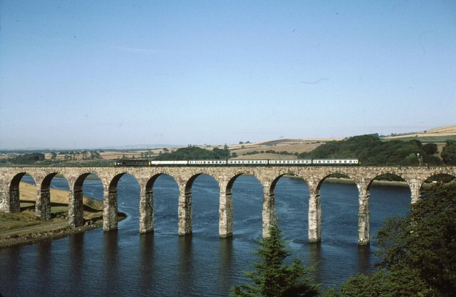
The Royal Border Bridge spans the River Tweed between Berwick-upon-Tweed and Tweedmouth in Northumberland, England. It is a Grade I listed railway viaduct built between 1847 and 1850, when it was opened by Queen Victoria. It was designed by Robert Stephenson (son of railway pioneer George Stephenson). It was built for the York, Newcastle and Berwick Railway and is still in regular use today, as part of the East Coast Main Line. Despite its name, the bridge does not in fact span the border between England and Scotland, which is approximately three miles further north. The bridge is 659 metres (2,162 ft) long and constructed in stone except for brick soffits to the arches. It has 28 arches, each spanning 60 feet (18 m). The railway is carried 37 metres (121 ft) above the river level. During 1989, it was electrified as a part of the wider East Coast Main Line electrification scheme. Between 1993 and 1996, the structure underwent significant repair work for the first time in a Railtrack-led project, which was partially funded by English Heritage.
- Category
- Photo Spots
- Location
- Northumberland, United Kingdom
- Coordinates
- 55.77200, -2.01400
- How to get there
- Google MapsApple MapsOpenStreetMap
- Wikidata
- Q2170969
What is Royal Border Bridge?
Royal Border Bridge is a Photo Spots place on VeroMaps. Other places close by: Berwick Castle, Berwick Bridge, Barmoor Castle, Etal Castle.
Where is Royal Border Bridge?
Royal Border Bridge is in Northumberland, United Kingdom. Coordinates: 55.77200, -2.01400.
How do I get to Royal Border Bridge?
Royal Border Bridge is at Northumberland, United Kingdom (55.77200, -2.01400). Enter these coordinates in Google Maps, Apple Maps or OpenStreetMap for walking, cycling or driving directions.