Photo corners
Pont Valentré
Cahors, France
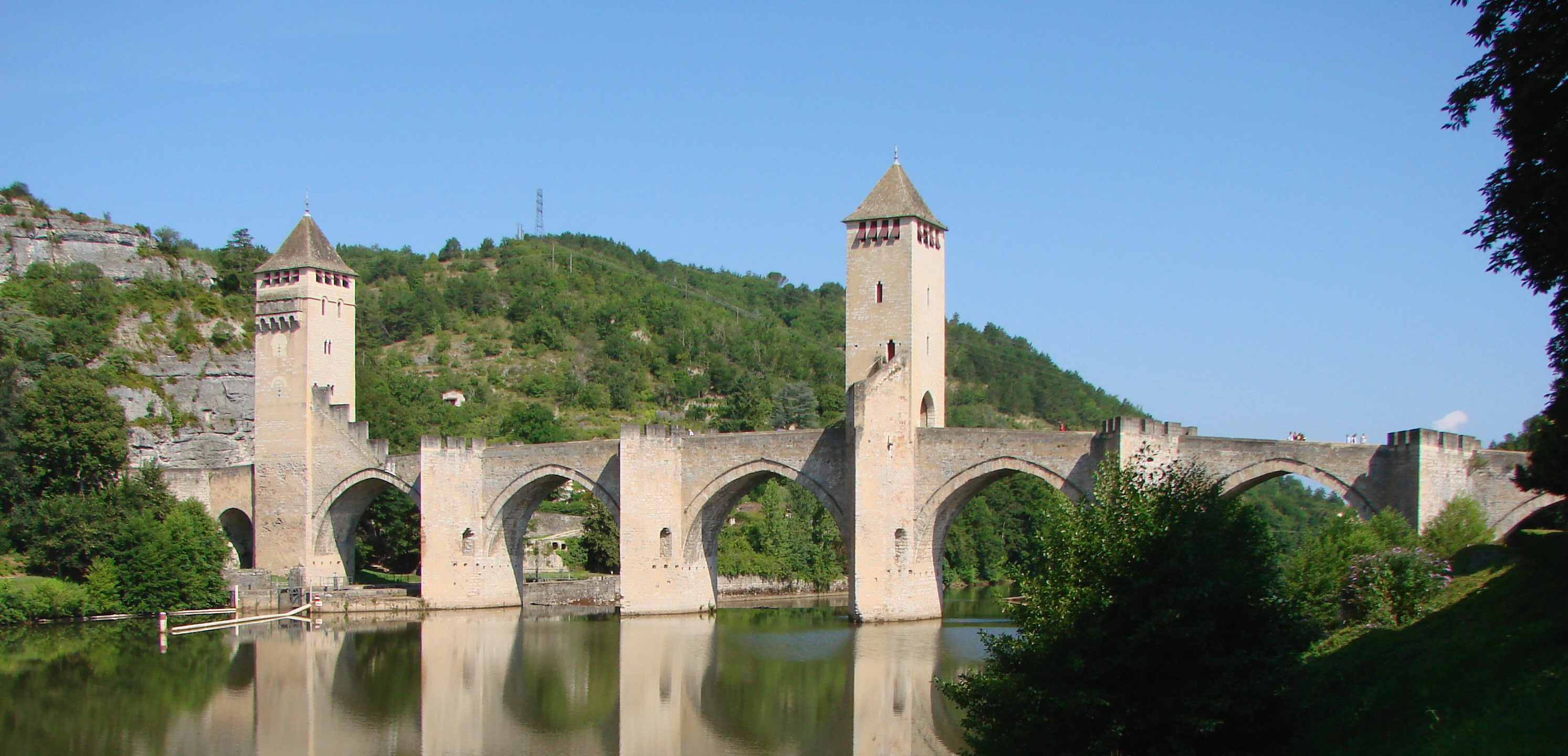
The Pont Valentré (French pronunciation: [pɔ̃ valɑ̃tʁe]) (Occitan: Pont de Balandras; English: Valentré Bridge) is a 14th-century six-span fortified stone arch bridge crossing the river Lot to the west of Cahors, in France. It has become a symbol of the city. After the decision was made to build it on 30 April 1306, construction began on 17 June 1308. It was built between 1308 and 1378 with six Gothic arches and three square bridge towers. It opened for use in 1350. It was originally fortified at both ends; the western tower has not survived. The bridge was built due to increasing tensions in the region between France and England that would eventually erupt into the Hundred Years' War around 30 years later. A major restoration was performed from 1867 to 1879 by Paul Gout. The bridge was classified in 1998 as a World Heritage Site. This bridge can only be crossed by foot.
- Category
- Photo Spots
- Location
- Cahors, France
- Coordinates
- 44.44508, 1.43179
- How to get there
- Google MapsApple MapsOpenStreetMap
- Wikidata
- Q1816823
What is Pont Valentré?
Pont Valentré is a Photo Spots place on VeroMaps. Other places close by: Château Lagrézette, Dolmens du Mas d'Arjac, Phosphatières du Cloup d'Aural, Chapelle Saint-André (Les Arques).
Where is Pont Valentré?
Pont Valentré is in Cahors, France. Coordinates: 44.44508, 1.43179.
How do I get to Pont Valentré?
Pont Valentré is at Cahors, France (44.44508, 1.43179). Enter these coordinates in Google Maps, Apple Maps or OpenStreetMap for walking, cycling or driving directions.