Forgotten History
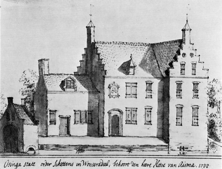
Osingastate
Súdwest-Fryslân, Netherlands
Osinga State was a fortified manor in Schettens, presumably dating from the 15th century. The state was inhabited by the noble Van Osinga family and from 1612 by the Van Aysma family. The last resident, Hotze Scheltes van Aysma, married Anna Geertruid Swaen in 1727, after which they moved to Zutphen. Afterwards, the state was converted into a farm.
- Category
- Forgotten History
- Location
- Súdwest-Fryslân, Netherlands
- Coordinates
- 53.21354, 5.84864
- How to get there
- Google MapsApple MapsOpenStreetMap
- Wikidata
- Q13137368
What is Osingastate?
Osingastate is a Forgotten History place on VeroMaps. Other places close by: De Schakel, Swarte Prinsch, Grutte Wielen, Froskepôlemolen.
Where is Osingastate?
Osingastate is in Súdwest-Fryslân, Netherlands. Coordinates: 53.21354, 5.84864.
How do I get to Osingastate?
Osingastate is at Súdwest-Fryslân, Netherlands (53.21354, 5.84864). Enter these coordinates in Google Maps, Apple Maps or OpenStreetMap for walking, cycling or driving directions.