Urbex & Abandoned
Mariscal Mine
River Rd., United States
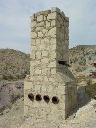
The Mariscal Mine, also known as the Lindsey Mine and the Ellis Mine, was a source of cinnabar ore that was refined at the Texas site into mercury. The mine is located in what is now Big Bend National Park. The mine produced a total of 1,400 flasks of mercury, each weighing 76 pounds (34 kg), accounting for almost a quarter of the mercury production in the United States between 1900 and 1943.
- Category
- Urbex & Abandoned
- Location
- River Rd., United States
- Coordinates
- 29.09500, -103.18700
- How to get there
- Google MapsApple MapsOpenStreetMap
- Wikidata
- Q6765598
What is Mariscal Mine?
Mariscal Mine is a Urbex & Abandoned place on VeroMaps.
Where is Mariscal Mine?
Mariscal Mine is in River Rd., United States. Coordinates: 29.09500, -103.18700.
How do I get to Mariscal Mine?
Mariscal Mine is at River Rd., United States (29.09500, -103.18700). Enter these coordinates in Google Maps, Apple Maps or OpenStreetMap for walking, cycling or driving directions.