Urbex & Abandoned
Leviathan Mine
California, United States
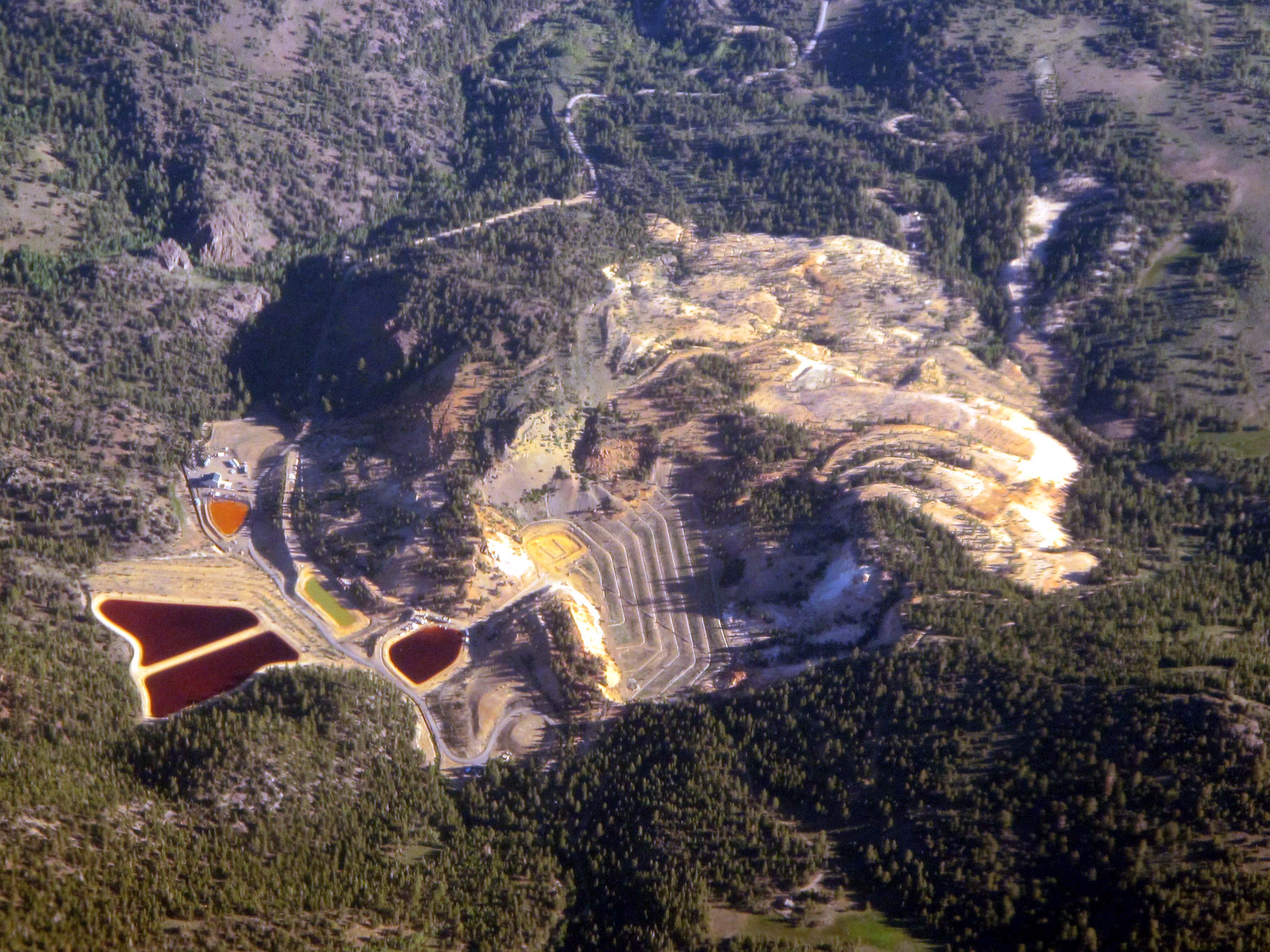
Leviathan Mine is a United States superfund site (CERCLIS ID: CAD98067685) at an abandoned open-pit sulfur mine located in Alpine County, California. The mine is located on the eastern slope of the Sierra Nevada at about 7,000-foot (2,100 m) elevation, 6 miles (9.7 km) east of Markleeville and 24 miles (39 km) southeast of Lake Tahoe. The mine site comprises approximately 250 acres (100 ha) of land surrounded by the Toiyabe National Forest, which is only accessible a few months a year. The approximately 22 million tons of sulfur ore-containing crushed rock at the mine are responsible for contaminating the Leviathan and Aspen Creek, which join with Mountaineer Creek to form Bryant Creek which ultimately empties into the East Fork of the Carson River. These water bodies are listed as 303(d) impaired. The site location is seismically active.
- Category
- Urbex & Abandoned
- Location
- California, United States
- Coordinates
- 38.70630, -119.65200
- How to get there
- Google MapsApple MapsOpenStreetMap
- Wikidata
- Q6535597
What is Leviathan Mine?
Leviathan Mine is a Urbex & Abandoned place on VeroMaps. Other places close by: Kirkwood Inn & Saloon, Harvey's Resort Hotel bombing, Anaconda Copper Mine, Kitzmeyer Furniture Factory.
Where is Leviathan Mine?
Leviathan Mine is in California, United States. Coordinates: 38.70630, -119.65200.
How do I get to Leviathan Mine?
Leviathan Mine is at California, United States (38.70630, -119.65200). Enter these coordinates in Google Maps, Apple Maps or OpenStreetMap for walking, cycling or driving directions.