Urbex & Abandoned
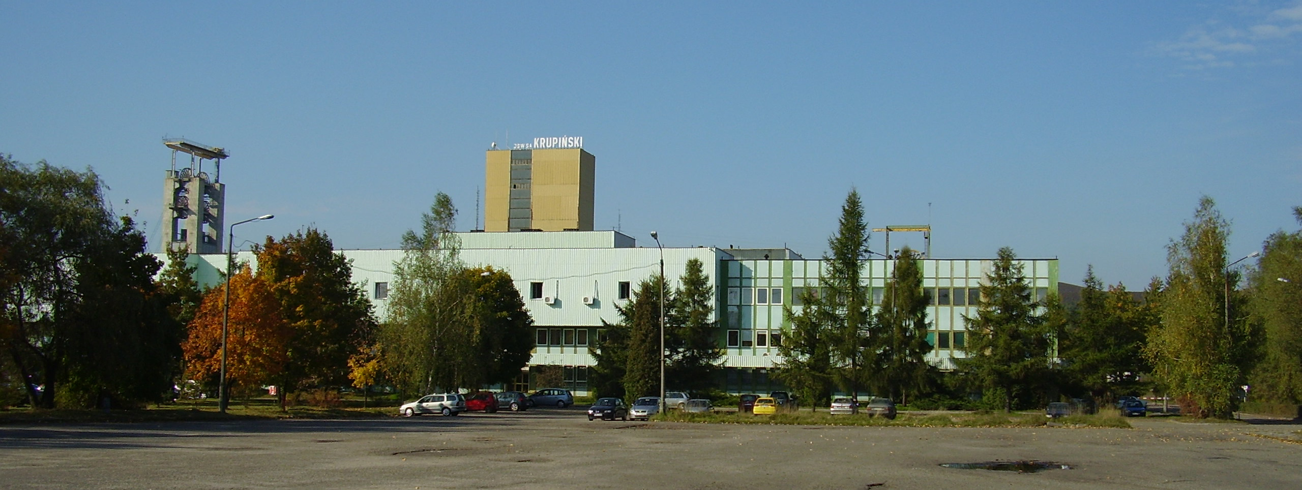
Krupiński Coal Mine
Silesian Voivodeship, Poland
The Krupiński coal mine is a large mine in the south of Poland in Suszec, Silesian Voivodeship, 448 km south-west of the capital, Warsaw. Krupiński represents one of the largest coal reserve in Poland having estimated reserves of 34.8 million tonnes of coal. The annual coal production is around 3 million tonnes. The mine is based in Suszec, the deposits of which are located in the commune of Suszec, Żory and Orzesze in the Silesian Voivodeship. Employment at the end of 2011 amounted to 2819 employees. March 31, 2017 production in the mine was shut down and the plant was transferred to the Spółka Restrukturyzacji Kopalń in Bytom. This company is liquidating and managing the assets of liquidated mines.
- Category
- Urbex & Abandoned
- Location
- Silesian Voivodeship, Poland
- Coordinates
- 50.04778, 18.77472
- How to get there
- Google MapsApple MapsOpenStreetMap
- Wikidata
- Q3501648
What is Krupiński Coal Mine?
Krupiński Coal Mine is a Urbex & Abandoned place on VeroMaps. Other places close by: Pniówek Coal Mine, Bolesław Śmiały Coal Mine, Zofiówka coal mine, Borynia Coal Mine.
Where is Krupiński Coal Mine?
Krupiński Coal Mine is in Silesian Voivodeship, Poland. Coordinates: 50.04778, 18.77472.
How do I get to Krupiński Coal Mine?
Krupiński Coal Mine is at Silesian Voivodeship, Poland (50.04778, 18.77472). Enter these coordinates in Google Maps, Apple Maps or OpenStreetMap for walking, cycling or driving directions.