Local Legends
Hundred Horse Chestnut
Sant'Alfio, Italy
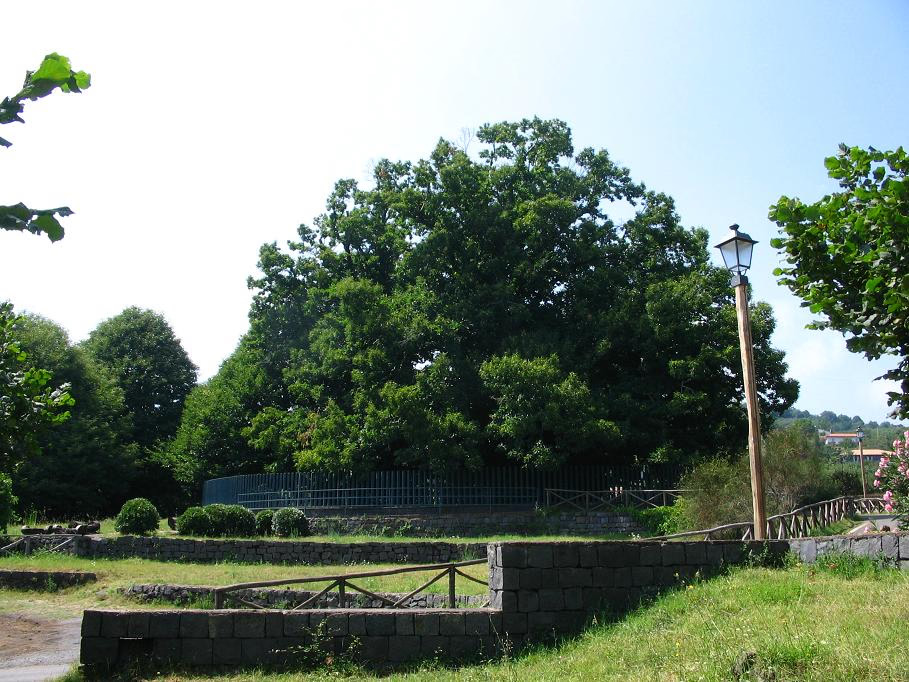
The Hundred-Horse Chestnut (Italian: Castagno dei Cento Cavalli; Sicilian: Castagnu dî Centu Cavaḍḍi) is the largest and oldest known sweet chestnut (Castanea sativa, family Fagaceae) in the world. Located on Linguaglossa road in Sant'Alfio, on the eastern slope of Mount Etna in Sicily — only 8 km (5 miles) from the volcano's crater — it is generally believed to be 2,000 to 4,000 years old (4,000 according to botanist Bruno Peyronel from Turin). Guinness World Records has listed it for the record of "Greatest Tree Girth Ever", noting that it had a circumference of 57.9 m (190 ft) when it was measured in 1780. Above ground, the tree has since split into multiple large trunks, but below ground, these trunks still share the same roots. An early 1895 image with a man next to the tree for perspective shows it was closer to 10 m (33 ft) in diameter at breast height, rather than the claimed 18.5 m (61 ft) in diameter at breast height. At present time it has a girth (130 cm or 4+1⁄4 ft) circumference of 10.51 m (34 ft) and it is 19.42 m (64 ft) high. Despite its name, the tree is not a horse chestnut. Rather, the tree's name originated from a legend in which a Spanish queen, Joanna of Castile, and her company of 100 knights, during a trip to Mount Etna, were caught in a severe thunderstorm. The entire company is said to have taken shelter under the tree.
- Category
- Local Legends
- Location
- Sant'Alfio, Italy
- Coordinates
- 37.74932, 15.13151
- How to get there
- Google MapsApple MapsOpenStreetMap
- Wikidata
- Q1520397
What is Hundred Horse Chestnut?
Hundred Horse Chestnut is a Local Legends place on VeroMaps. Other places close by: Pozzo di Ruggero, Grotta del Gelo, Acireale Cathedral, Grotta Azzurra.
Where is Hundred Horse Chestnut?
Hundred Horse Chestnut is in Sant'Alfio, Italy. Coordinates: 37.74932, 15.13151.
How do I get to Hundred Horse Chestnut?
Hundred Horse Chestnut is at Sant'Alfio, Italy (37.74932, 15.13151). Enter these coordinates in Google Maps, Apple Maps or OpenStreetMap for walking, cycling or driving directions.