Photo corners
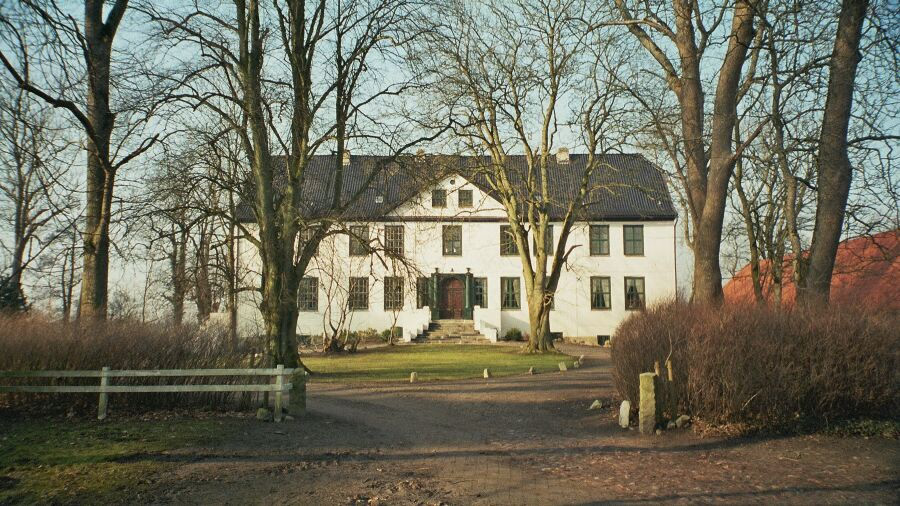
Gut Dollrott
Dollrottfeld, Germany
Gut Dollrott (dänisch: Dollerød) ist ein zum Gutshaus ausgebautes Pforthaus aus dem 17. Jahrhundert. Das Gut befindet sich im Ortsteil Dollrottfeld der Gemeinde Süderbrarup an der B 201 zwischen Süderbrarup und Kappeln in der Landschaft Angeln.
- Category
- Photo Spots
- Location
- Dollrottfeld, Germany
- Coordinates
- 54.64350, 9.83264
- How to get there
- Google MapsApple MapsOpenStreetMap
- Wikidata
- Q1415994
What is Gut Dollrott?
Gut Dollrott is a Photo Spots place on VeroMaps. Other places close by: Kummerhy tomb, Gut Roest, Gut Rundhof, Gut Grünholz.
Where is Gut Dollrott?
Gut Dollrott is in Dollrottfeld, Germany. Coordinates: 54.64350, 9.83264.
How do I get to Gut Dollrott?
Gut Dollrott is at Dollrottfeld, Germany (54.64350, 9.83264). Enter these coordinates in Google Maps, Apple Maps or OpenStreetMap for walking, cycling or driving directions.