Photo corners
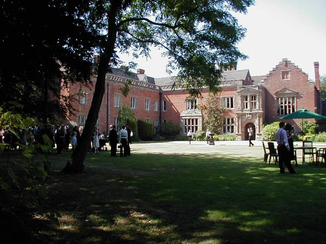
Grafton Manor
Dodford with Grafton, United Kingdom
Grafton Manor (13 miles north-east of Worcester and 2 1/2 miles south-west of Bromsgrove, Worcestershire) was established before the Norman Conquest. Grafton means "settlement at or near the wood" and may indicate a role in woodland management within a larger estate, for instance. For a time, in the reigns of Henry II to Edward I, it was subject to forest law as part of the Forest of Feckenham. The Lords of the Manor were influential figures in medieval and early modern Worcestershire, with a number becoming High Sheriffs or Members of Parliament for Worcestershire. A few were also national figures, especially the Talbots and Earls of Shrewsbury. Grafton was connected with Catholic worship in the County after the Reformation. The house is now a listed building in the modern Civil parish of Dodford with Grafton in the Bromsgrove District of Worcestershire.
- Category
- Photo Spots
- Location
- Dodford with Grafton, United Kingdom
- Coordinates
- 52.32060, -2.09090
- How to get there
- Google MapsApple MapsOpenStreetMap
- Wikidata
- Q5592550
What is Grafton Manor?
Grafton Manor is a Photo Spots place on VeroMaps. Other places close by: Artrix, Barnt Green Inn, Coughton Court, Birmingham Battery and Metal Company.
Where is Grafton Manor?
Grafton Manor is in Dodford with Grafton, United Kingdom. Coordinates: 52.32060, -2.09090.
How do I get to Grafton Manor?
Grafton Manor is at Dodford with Grafton, United Kingdom (52.32060, -2.09090). Enter these coordinates in Google Maps, Apple Maps or OpenStreetMap for walking, cycling or driving directions.