Forgotten History
Fort Kruipin
Woerden, Netherlands
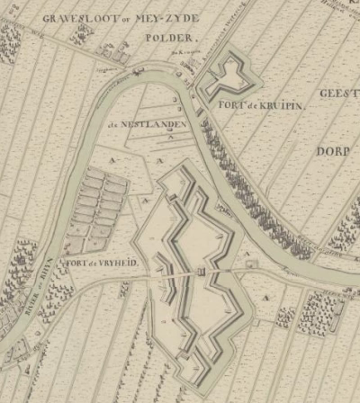
Fort Kruipin, also called Fort de Kruipin, was a fortress on the north side of the current Oude Rijn in Woerden. Fort Oranje stood on the south side at the same height. The forts were built in 1747/1748 and were part of the First Dutch Waterline. Fort Kruipin was closed after 1816.
- Category
- Forgotten History
- Location
- Woerden, Netherlands
- Coordinates
- 52.09628, 4.89442
- How to get there
- Google MapsApple MapsOpenStreetMap
- Wikidata
- Q2195232
What is Fort Kruipin?
Fort Kruipin is a Forgotten History place on VeroMaps. Other places close by: Watertoren, Lutherse Kerk, Woerden, Sint-Bonaventurakerk, Sint-Petruskerk.
Where is Fort Kruipin?
Fort Kruipin is in Woerden, Netherlands. Coordinates: 52.09628, 4.89442.
How do I get to Fort Kruipin?
Fort Kruipin is at Woerden, Netherlands (52.09628, 4.89442). Enter these coordinates in Google Maps, Apple Maps or OpenStreetMap for walking, cycling or driving directions.