Forgotten History
Ellewoutsdijk Fort
Kustbatterij Fortweg, Netherlands
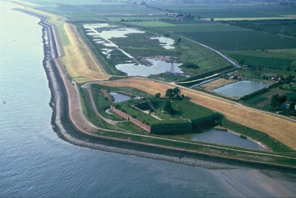
Fort Ellewoutsdijk is a defense structure dating from 1839. Since 1981 it has been the property of the Natuurmonumenten Association. In 1830, after the separation from Belgium, the Netherlands began building coastal forts on both banks of the Western Scheldt to control shipping towards Antwerp.
- Category
- Forgotten History
- Location
- Kustbatterij Fortweg, Netherlands
- Coordinates
- 51.38667, 3.81306
- How to get there
- Google MapsApple MapsOpenStreetMap
- Wikidata
- Q2340786
What is Ellewoutsdijk Fort?
Ellewoutsdijk Fort is a Forgotten History place on VeroMaps. Other places close by: Kasteel Ellewoutsdijk, De Blazekop, De Hoop & Verwachting, Goede Herderkerk.
Where is Ellewoutsdijk Fort?
Ellewoutsdijk Fort is in Kustbatterij Fortweg, Netherlands. Coordinates: 51.38667, 3.81306.
How do I get to Ellewoutsdijk Fort?
Ellewoutsdijk Fort is at Kustbatterij Fortweg, Netherlands (51.38667, 3.81306). Enter these coordinates in Google Maps, Apple Maps or OpenStreetMap for walking, cycling or driving directions.