Local Legends
Dolmen of Menga
Antequera, Spain
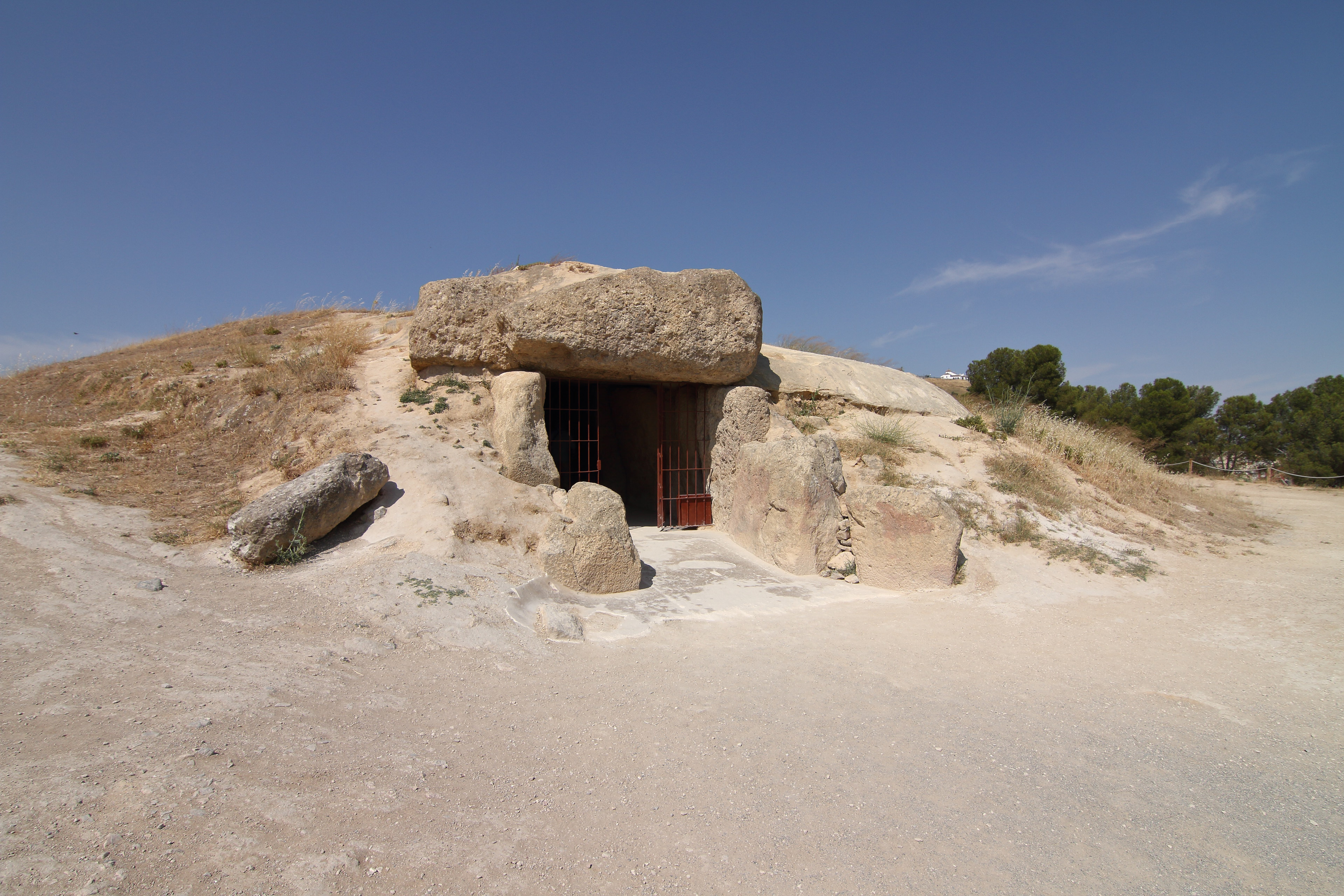
The Dolmen of Menga (Spanish: Dolmen de Menga) is a megalithic burial mound called a tumulus, a long barrow form of dolmen, dating from the Neolithic period around 3750–3650 BCE. It is near Antequera, Málaga, Spain. It is one of the largest known ancient megalithic structures in Europe. It is 27.5 metres (90 ft) long, 6 metres (20 ft) wide and 3.5 metres (11 ft) high, and was built with thirty-two megaliths, the largest weighing about 180 tonnes (200 tons). After completion of the chamber (which probably served as a grave for the ruling families) and the path leading into the center, the stone structure was covered with soil and built up into the hill that can be seen today. When the grave was opened and examined in the 19th century, archaeologists found the skeletons of several hundred people inside. The dolmen sits 70 metres (230 ft) from the Dolmen de Viera and about 4 kilometres (2.5 mi) from another subterranean structure known as Tholos de El Romeral. In 2016, the dolmens of Menga, Viera, and El Romeral were all inscribed as a UNESCO World Heritage Site under the name Antequera Dolmens Site.
- Category
- Local Legends
- Location
- Antequera, Spain
- Coordinates
- 37.02402, -4.54846
- How to get there
- Google MapsApple MapsOpenStreetMap
- Wikidata
- Q1143218
What is Dolmen of Menga?
Dolmen of Menga is a Local Legends place on VeroMaps. Other places close by: Dolmen of Viera, Antequera's Alcazaba, Tholos de El Romeral, Convento de la Magdalena.
Where is Dolmen of Menga?
Dolmen of Menga is in Antequera, Spain. Coordinates: 37.02402, -4.54846.
How do I get to Dolmen of Menga?
Dolmen of Menga is at Antequera, Spain (37.02402, -4.54846). Enter these coordinates in Google Maps, Apple Maps or OpenStreetMap for walking, cycling or driving directions.