Local Legends
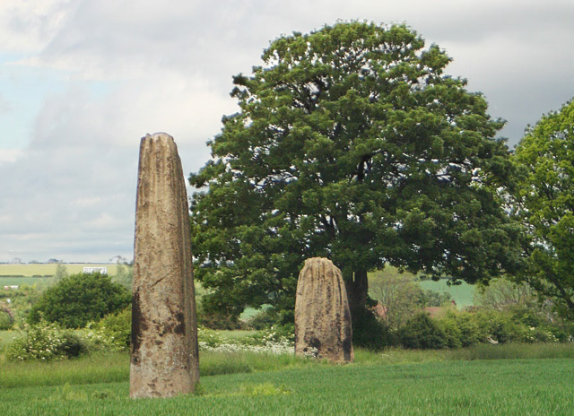
Devil's Arrows
Boroughbridge, United Kingdom
The Devil's Arrows are three aligned standing stones located outside Boroughbridge in North Yorkshire, England, near to where the A168 road (previously the A1) crosses the River Ure. The southernmost of the three remaining stones is the second tallest in the UK.
- Category
- Local Legends
- Location
- Boroughbridge, United Kingdom
- Coordinates
- 54.09300, -1.40347
- How to get there
- Google MapsApple MapsOpenStreetMap
- Wikidata
- Q1419372
What is Devil's Arrows?
Devil's Arrows is a Local Legends place on VeroMaps. Other places close by: The Three Horse Shoes Public House, Punch Bowl Inn, Allerton Castle, Commercial Inn.
Where is Devil's Arrows?
Devil's Arrows is in Boroughbridge, United Kingdom. Coordinates: 54.09300, -1.40347.
How do I get to Devil's Arrows?
Devil's Arrows is at Boroughbridge, United Kingdom (54.09300, -1.40347). Enter these coordinates in Google Maps, Apple Maps or OpenStreetMap for walking, cycling or driving directions.