Forgotten History
Ciampate del Diavolo
Campania, Italy
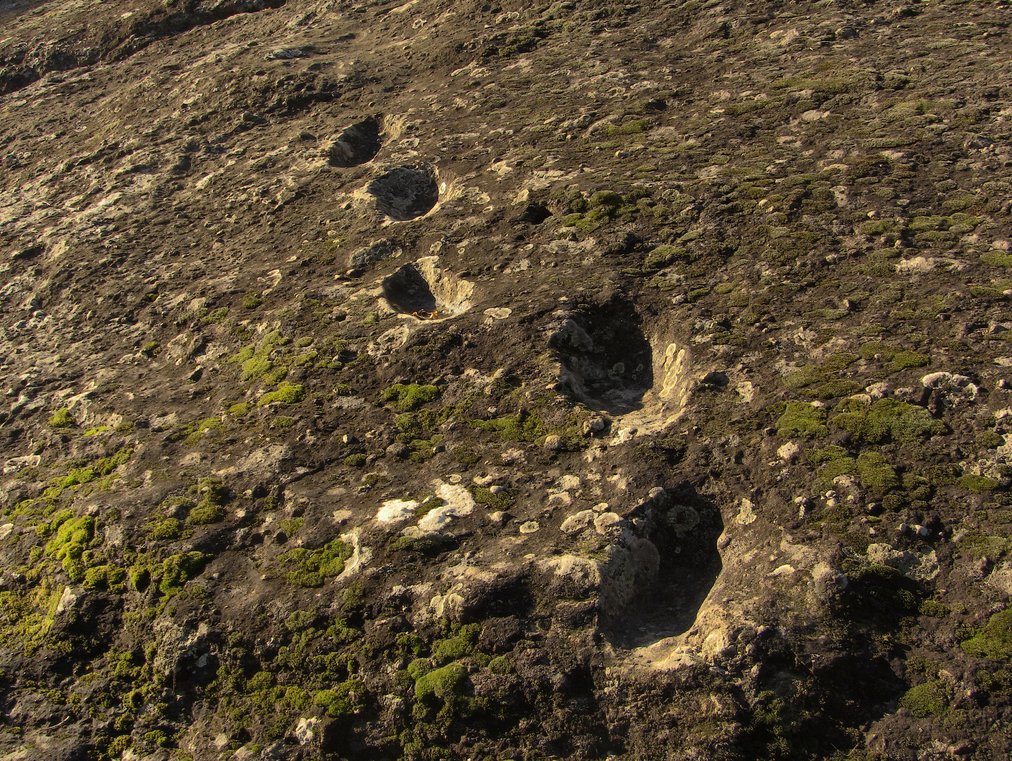
The Ciampate del Diavolo (Neapolitan: "Devil's Footprints" or "Devil's Trails") is a locality near the extinct Roccamonfina volcano in northern Campania, Italy. It is named after fossilised footprints preserved in pyroclastic flow deposits that have been dated to around 350,000 years ago. They have been attributed to bipedal hominids, possibly Homo heidelbergensis, which is known to have inhabited the region at the time. The footprints comprise three sets of tracks indicating that three hominids made their way down a steep slope on the flank of the volcano, away from the crater. The tracks were preserved under a layer of volcanic ash and were revealed by erosion, probably in the late 18th to early 19th century. Local people attributed the prints to the Devil as they regarded him as the only being capable of walking on lava without harm. They were identified as hominid footprints after archaeologists examined them in 2002 and are the second oldest set of hominid footprints known outside Africa, after the Happisburgh footprints.
- Category
- Forgotten History
- Location
- Campania, Italy
- Coordinates
- 41.33253, 14.02458
- How to get there
- Google MapsApple MapsOpenStreetMap
- Wikidata
- Q867156
What is Ciampate del Diavolo?
Ciampate del Diavolo is a Forgotten History place on VeroMaps. Other places close by: Cathedral of St. Clement, Cattedrale di Sessa Aurunca, Real Ferdinando Bridge, Capua Cathedral.
Where is Ciampate del Diavolo?
Ciampate del Diavolo is in Campania, Italy. Coordinates: 41.33253, 14.02458.
How do I get to Ciampate del Diavolo?
Ciampate del Diavolo is at Campania, Italy (41.33253, 14.02458). Enter these coordinates in Google Maps, Apple Maps or OpenStreetMap for walking, cycling or driving directions.