Forgotten History
Castle of Burgos
Burgos, Spain
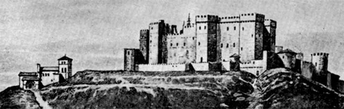
The Castle of Burgos was a castle and alcázar, located in the city of Burgos, in the hill of San Miguel to 75 metres (246 ft) above the city and to 981 metres (3,219 ft) above the sea. This hill was the subject of archaeological surveys by General Centeno in the years 1925 and 1926 trying to find Napoleonic military files from when the French in their retreat blew up the fortress. According to the results obtained in this excavation the origin of the castle dates to the Visigoths, and its oldest parts, to the Romans. The castle grew over the centuries, becoming a major fortification and residence of the kings of Castile. Following the accession of the Habsburg family the castle lost its importance as a royal residence, and during the French occupation, on 15 June 1813, the French army decided to leave the Castle of Burgos, and they destroyed it with explosives. The explosion resulted in the almost total destruction of all the castle grounds. The castle remains in ruins.
- Category
- Forgotten History
- Location
- Burgos, Spain
- Coordinates
- 42.34280, -3.70722
- How to get there
- Google MapsApple MapsOpenStreetMap
- Wikidata
- Q4099435
What is Castle of Burgos?
Castle of Burgos is a Forgotten History place on VeroMaps. Other places close by: Chapel of Santa Ana, Burgos Cathedral, Capilla de la Divina Pastora, Estatua del Cid, 2009 Burgos bombing.
Where is Castle of Burgos?
Castle of Burgos is in Burgos, Spain. Coordinates: 42.34280, -3.70722.
How do I get to Castle of Burgos?
Castle of Burgos is at Burgos, Spain (42.34280, -3.70722). Enter these coordinates in Google Maps, Apple Maps or OpenStreetMap for walking, cycling or driving directions.